
How Drones are Revolutionizing Forestry
How Drones are Revolutionizing Forestry
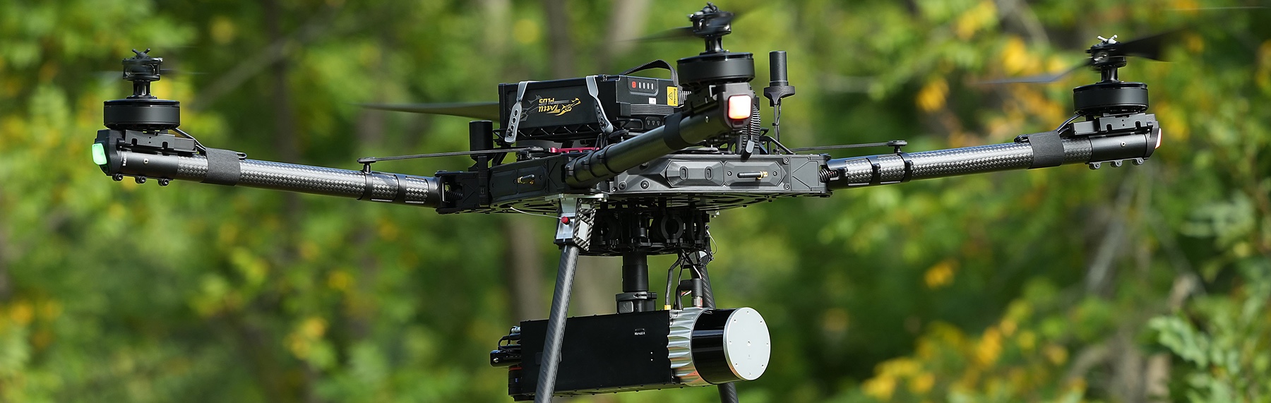
Drones have transformed forestry by providing a versatile, cost-effective way to gather precise, real-time data. Equipped with advanced sensors and high-resolution cameras, drones offer foresters invaluable tools to enhance existing management practices. Today, drones play a significant role in various natural resources applications, such as:
Mapping Forests
Drones can create detailed maps of forested areas, tracking
changes over time and assessing environmental factors such as tree height, canopy
cover, and gaps in the forest
Surveying Animal Populations
Drones efficiently monitor wildlife across large or inaccessible areas using automated detection with high-resolution imagery and sensors, improving accuracy for tracking elusive species.
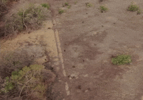
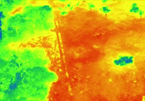
Monitoring Wildfires
Drones help track and map wildfires in real-time, providing
firefighters and decision-makers with up-to-date information to combat fires
effectively.
The Role of Drones in Digital Forestry
The Institute for Digital Forestry leverages drone technology to collect and analyze data with unprecedented accuracy. By integrating cutting-edge technology such as LiDAR (Light Detection and Ranging) and high-resolution imagery, Digital Forestry employs drones for:
- Rapid and Efficient Data Acquisition: Drones, equipped with a combination of multispectral, hyperspectral, and thermal sensors, gather extensive data on forest composition, tree health, soil conditions, and environmental changes. The drone’s ability to cover large areas quickly and efficiently enables continuous monitoring and frequent updates.
- Conducting Tree Inventories: Drones equipped with LiDAR sensors emit laser pulses to capture detailed 3D data. This technology enables the creation of precise forest inventories by accurately measuring tree location, diameter, tree height, canopy cover, forest density, and even estimating biomass.
- Mapping Canopy Gaps and Creating Canopy Height Models (CHMs): Highresolution cameras and sensors on drones capture data to create Canopy Height Models (CHMs), which provide insights into forest structure. CHMs help identify and map canopy gaps, track forest regeneration, and assess tree growth patterns.
- Monitoring Wildfires: High-precision sensors enable real-time mapping of fire patterns, assessment of damage, and predictions of fire spread, supporting swift and informed decision-making.
Through these applications, the integration of drone technology in Digital Forestry is not only increasing the efficiency of forest management but also advancing conservation efforts and ecological research.