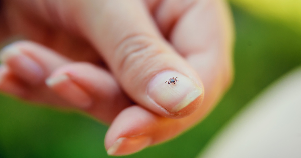
the big idea logo

The Big Idea: How Climate Projections are Made

How do scientists roughly predict the climate in 50 or 100 years?

  • Teams around the world have developed over 30 complex mathematical models to simulate the interconnected workings of Earth’s atmosphere, land, oceans and ice sheets.
  • They use the models’ projections based on different trajectories for the concentration of greenhouse gases in the atmosphere to gain an idea of how different levels will affect the future climate.

How did we refine projections for Indiana’s climate?

  • Each model represents the world in a different way. The Indiana Climate Change Impacts Assessment (IN CCIA) team chose 10 models that capture the range of model variability and best represent historical changes in the Midwest.
  • Indiana projections used the “high” and “moderate” trajectories of greenhouse gas concentrations adopted by the Intergovernmental Panel on Climate Change. High represents a scenario where we use fossil fuels until the end of the century; medium, a future where we rapidly limit use of fossil fuels.
  • The team then used statistical downscaling to make more finely calibrated projections, using 98 years of regional meteorological data.

Step 1

Compile Indiana Data

logos of data points: temperature, rain, steam, gas emissions and humidty

98 years of data regional records kept since 1915

575 active data stations in Indiana

1000+ weather stations in Indiana

not including upper-air stations, buoys, radars, aircraft, etc.

Step 2

Use statistical downscaling

to overlay local climate relationships on the model projections.

8bit map of Indiana

Step 3

Analyze results

Downscaling using Indiana data can help us more accurately predict many aspects of our future climate, including precipitation, extreme weather events and temperature projections, shown below.

Indiana’s climate will warm dramatically, particularly in summer.

heat map of southern united states with Houston highlight and temperature gauge

With 2080 high emissions, Indiana summers will feel like living in Houston

cold map of southern united states with Washington DC highlight

With 2080 high emissions, Indiana winters will feel like living in Washington, D.C.

Purdue’s Climate Change Research Center led the IN CCIA team. Faculty and staff from Purdue, the University of Notre Dame, Ball State University, Indiana University and the Midwestern Regional Climate Center examined historical climate trends and developed future projections for Indiana’s climate.

Learn more about the impact of climate change.