About
The Purdue Mesonet, managed by the Indiana State Climate Office, is a statewide network of weather observation stations that monitor Indiana weather and deliver climate data, tools, data visualizations, and resources to enhance Indiana's prosperity and decision-support needs.
Featured Podcasts and Articles
Weather Authority NOW: Getting to know Indiana Mesonet - FOX59 Meteorologist Ethan Rosuck
Purdue Mesonet Mission
- Monitor and assess Indiana weather and climate conditions and impacts to increase community safety, prosperity, and preparedness for extreme conditions
- Provide free, research-grade weather and climate data, derived information, data summaries, and decision-support tools
- Improve spatial coverage of a wide range of weather data in Indiana to enhance science, planning, and safety
- Increase the visibility and understanding of the value of weather and climate data and monitoring through community outreach
Locations and Measurements
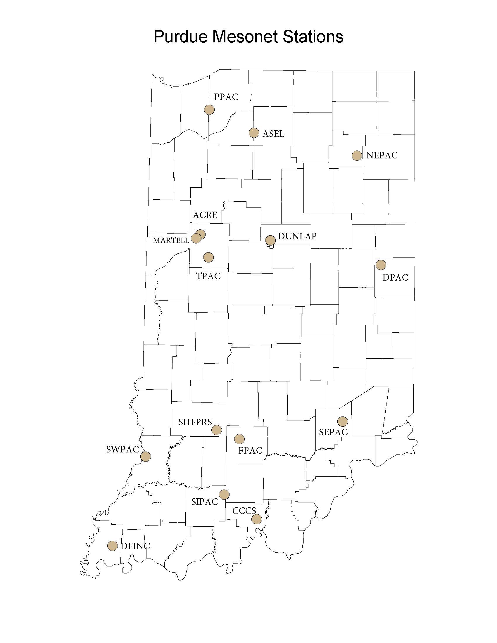
The Indiana State Climate Office maintains weather stations across the state (right) where real-time measurements are reported in 5-minute, 30-minute, hourly, daily, and monthly temporal intervals.
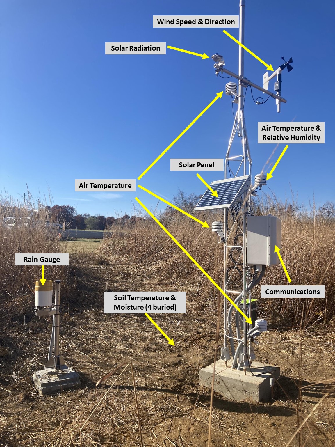
Measured variables include:
- Air temperature 0.5, 1.5, 2, and 3 meters (1.6, 4.9, 6.6, and 9.8 feet)
- Soil temperature and moisture depths of 5, 10, 20, and 40 centimeters (2, 4, 8, and 20 inches)
- Solar radiation
- Relative humidity
- Precipitation
- Wind speed and direction 3 meters (9.8 feet)
See Labeled Mesonet Station Photo.
Purdue Mesonet Data Hub
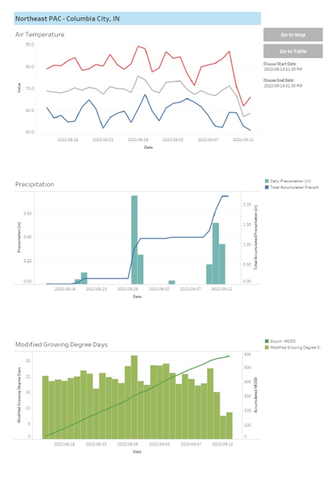
Compare real-time Indiana weather conditions through the Purdue Mesonet Data Hub. Access free 5-minute, hourly, and daily station graphs and tabular data from each station. View the measured variables in addition to calculated Modified Growing Degree Days (MGDDs) and monitor localized low-level temperature inversions, which have agricultural implications across the state.
See Mesonet Data Hub Time Series graphs.

Labeled Mesonet Station

Mesonet Data Hub Time Series

Partners
Thank you to our site hosts!
- ACRE - Purdue Agronomy Center for Research & Education
- ASEL - Asel Farms
- CCCS - Crawford County Community Schools, Purdue Extension Crawford County, and Crawford County Emergency Management Agency
- DFINC - Dutchman Farms Inc.
- DUNLAP - Dunlap Family Farms
- DPAC - Davis Purdue Agricultural Center
- FPAC - Feldun Purdue Agricultural Center
- MARTELL - Martell Forest
- NEPAC - Northeast Purdue Agricultural Center
- PPAC - Pinney Purdue Agricultural Center
- SEPAC - Southeast Purdue Agricultural Center
- SHFPRS - Shawnee Hills Farm Permaculture Research Station
- SIPAC - Southern Indiana Purdue Agricultural Center
- SWPAC - Southwest Purdue Agricultural Center
- TPAC - Throckmorton Purdue Agricultural Center
Professional Partners
- NMP - National Mesonet Program
- IWBN - Indiana Water Balance Network managed by the Indiana Geological & Water Survey
- AASC - American Association of State Climatologists
- Midwest Mesonet Consortium
