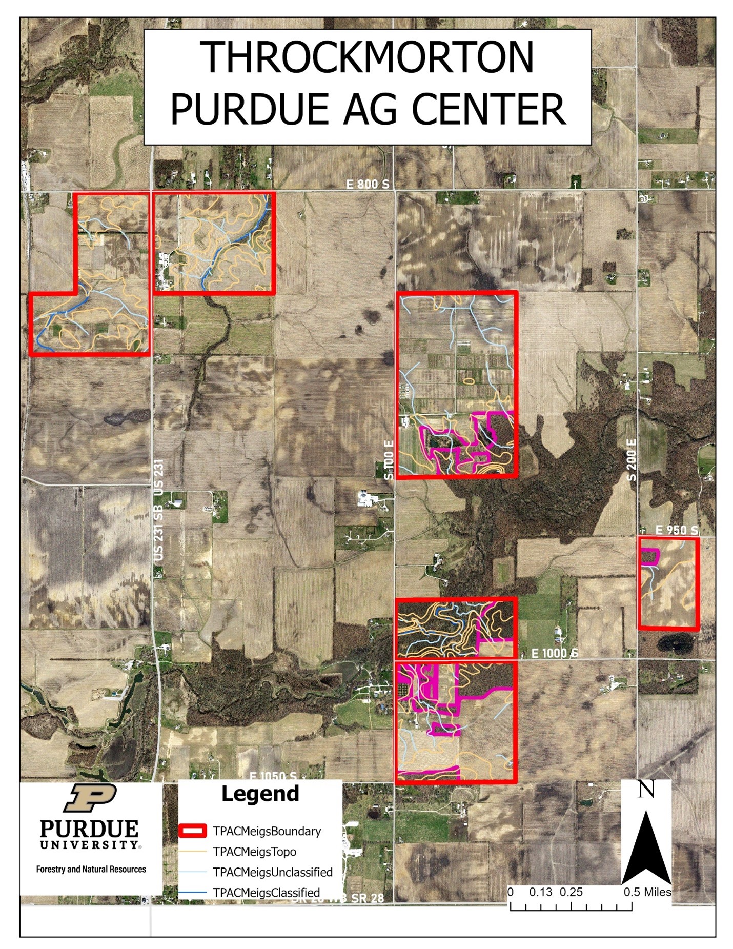
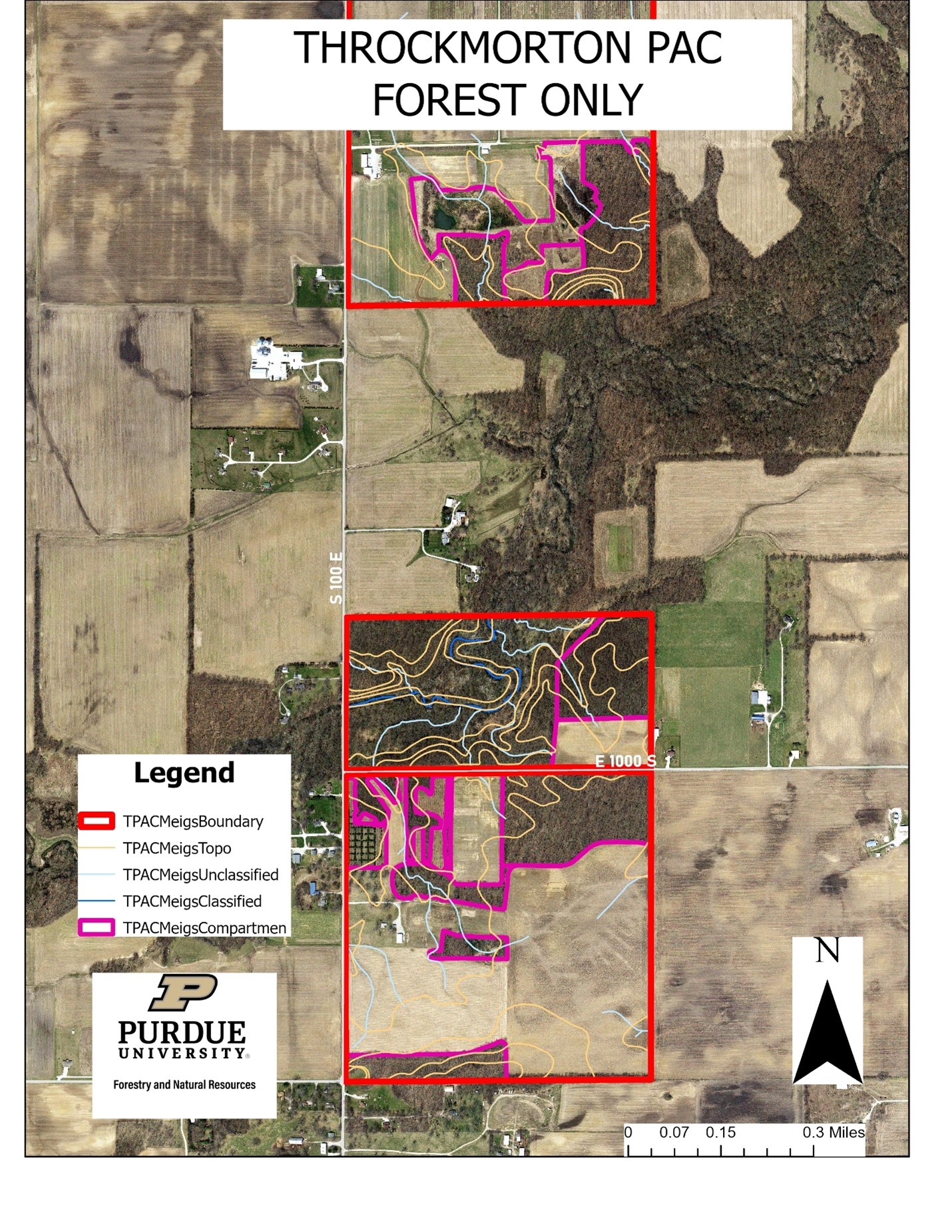
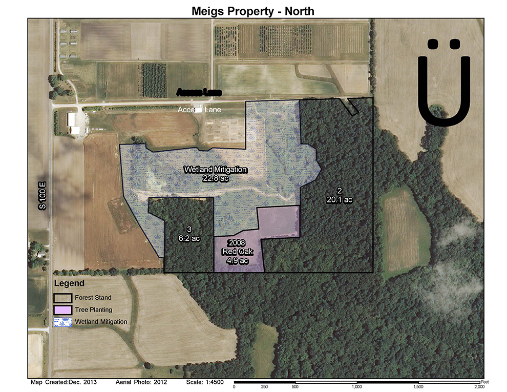
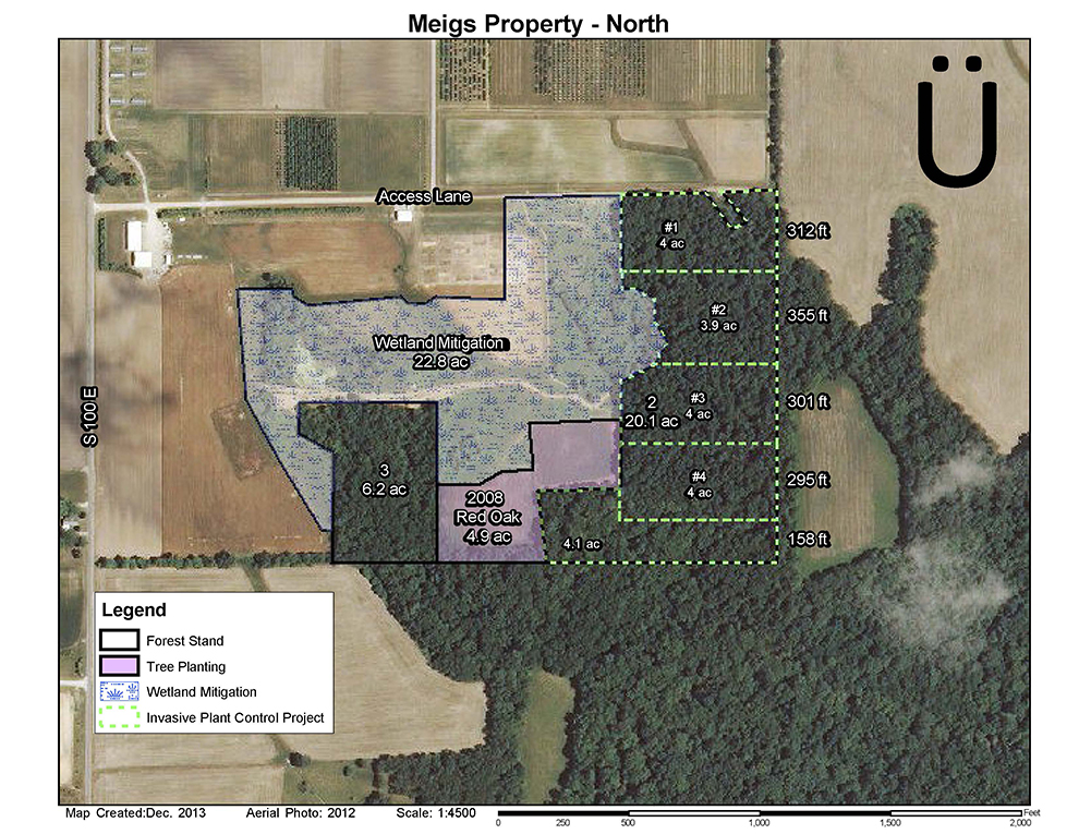
Throckmorton/Meigs Purdue Ag Center - Forestland
Dr. George Throckmorton donated the property in 1935 in memory of his father, Edmund. It was was named the “Edmund Throckmorton Farm Memorial.” In the late 1990s, horticultural and specialty crop research was moved to the Meigs Farm, which is a part of TPAC. There are 4 separate land parcels today – the home farm, Meigs North, Meigs South, and Meigs East.
Property Statistics
- Acres: 836 total, 184 forested
- Acquired: 1935
PAC Information
More About Throckmorton/Meigs Purdue Ag Center
- Occurrence and abundance of acorn weevils in fragmented landscapes
- Effects of landscape pattern on animal-mediated acorn dispersal and seedling recruitment
- HTIRC (Hardwood Tree Improvement and Regeneration Center) black walnut and red oak research trials
- Growth response of planted American chestnut following a midstory removal
- White-tailed deer browse preference study
- Home to almost 1/3 of Purdue agricultural research projects, with current work involving 30 different crops
- Two large wetland areas onsite provides great habitat to wildlife
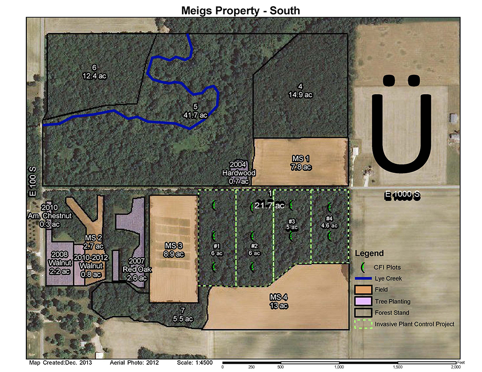
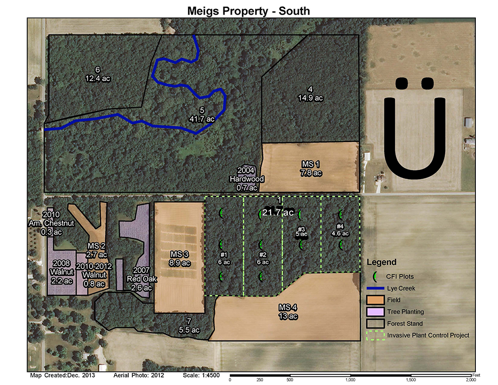
- Property is divided by a north and south location by East 1000 South
- FNR forestry capstone class has used this class
- Invasive Plant Control Project (IPCP) implementation – 2003
Please contact the property manager for a copy of this property’s management plan.
Forestland Property Manager
Brian Beheler
Phone: 765-496-5015
Fax: 765-583-3512
Email: behelerb@purdue.edu
Soil, Crop, Fruit & Vegetable Production Research
Jay Young
Phone: 765-538-3422
Fax: 765-583-3512
Email: jayyoung@purdue.edu
TPAC Website
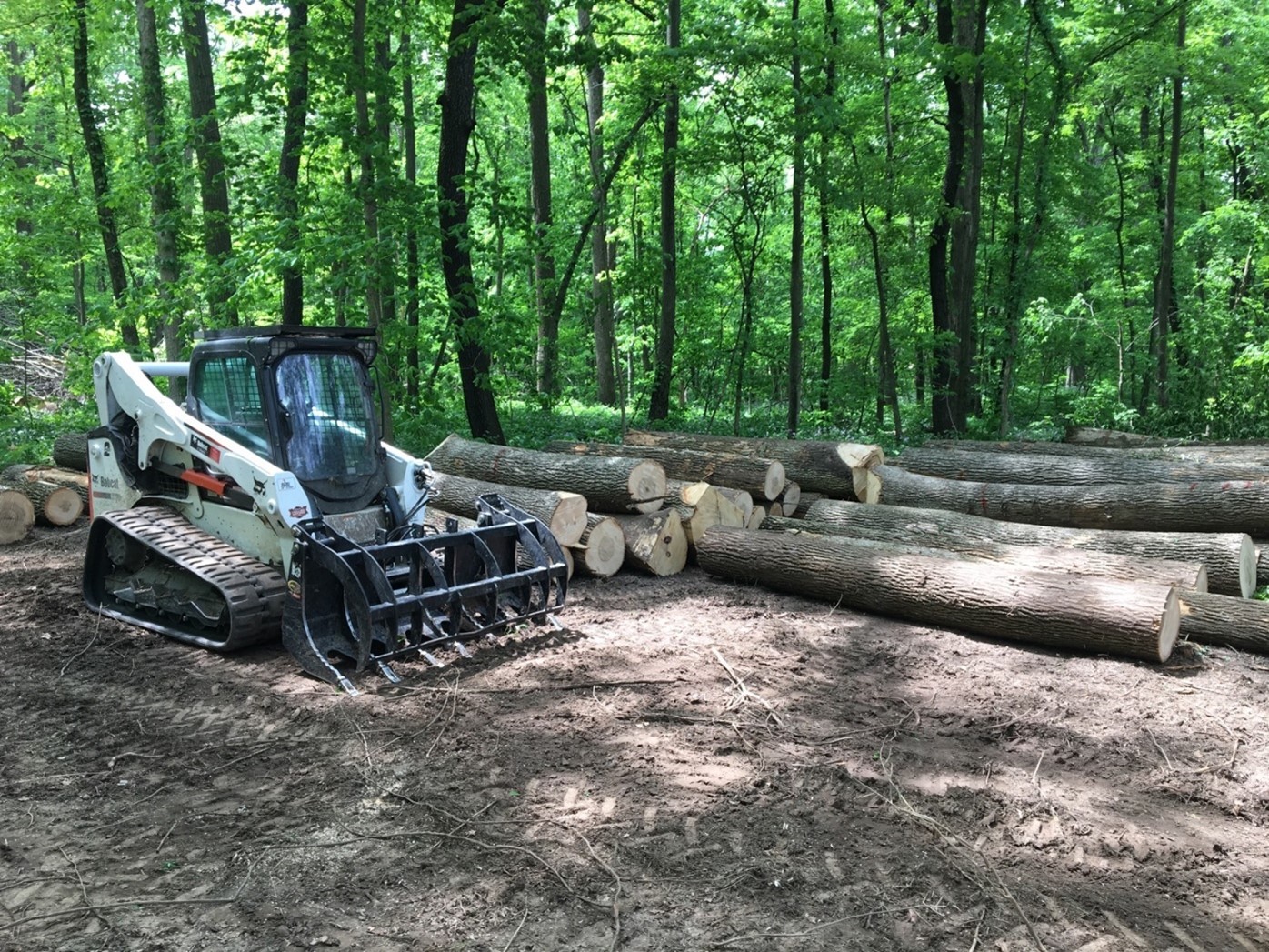 Meigs south woods ash tree salvage log landing. Photo by Brian Beheler.
 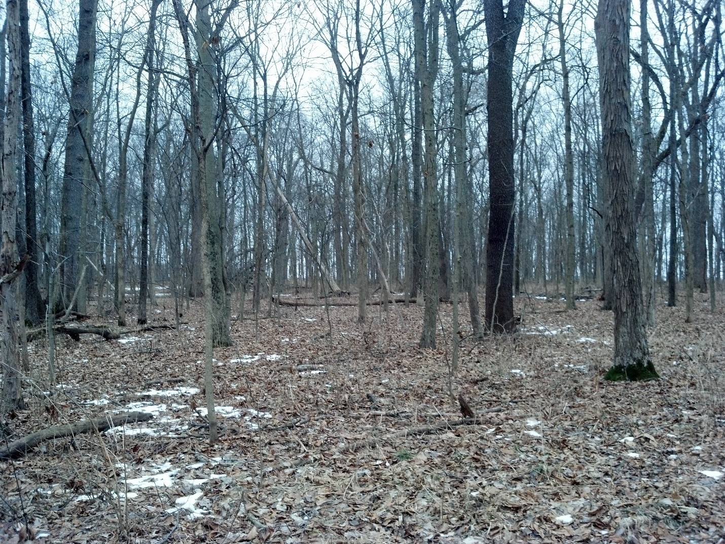 Meigs South photograph taken by Don Carlson.
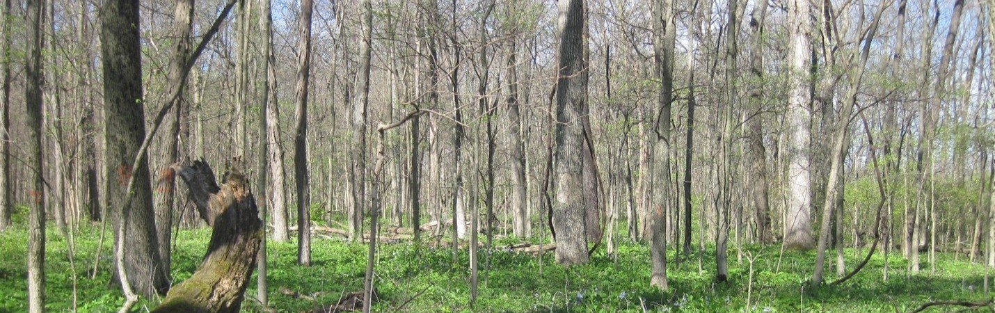