

Remote sensing, digital tech advance tools for precision forestry
Powerful partnerships among Purdue University's colleges of agriculture, engineering and science will advance digital forestry tools to save time, money and achieve a deeper understanding of an important natural resource.
"We must improve the sustainability and resilience of our forests, which are critical to the environment, our economy and our quality of life," says Songlin Fei, the Dean's Remote Sensing Chair and professor of forestry and natural resources who leads the initiative. "We're bringing together expertise from Purdue's renowned strengths in agriculture, engineering and science to create tools to better measure, monitor and manage forests of all sizes throughout the U.S."
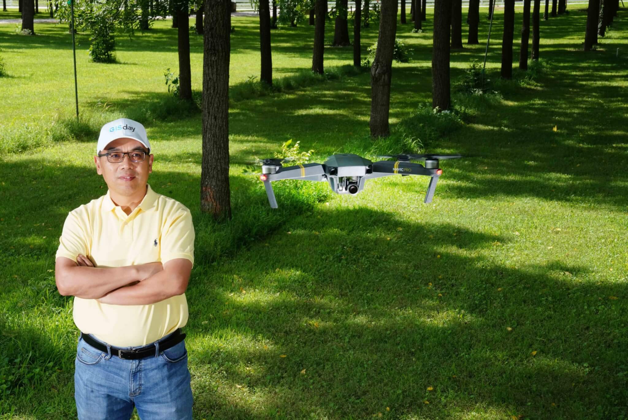 Songlin Fei, director of the digital forestry initiative and the Dean's Remote Sensing Chair.
 Forest management primarily uses conventional methods that have not changed in decades, including manual measurement of individual trees. This is time consuming and infeasible for large forests, he says.
"We want to help transition the field to data-driven, AI-supported precision forest management," Fei says about the initiative, which is part of Purdue's Next Moves. "We also plan to become a leader in education programs that prepare the next generation workforce for the information age."
To achieve that goal, Fei is bringing together experts from a variety of disciplines including forestry, entomology, ecology, engineering, geomatics, aviation technology, remote sensing, machine learning, data analysis and visualization, robotics, IoT, and geospatial information retrieval.
Digital Photogrammetry Research Group.
Photo provided by Ayman Habib.
The multidisciplinary collaborations fostered through the initiative will be the key to success, says Ayman Habib, the Thomas A. Page Professor of Civil Engineering and head of Purdue's Digital Photogrammetry Research Group.
"The ability to put world renowned engineering and agriculture researchers together is a unique strength at Purdue and it is very powerful," Habib says. "Through these different perspectives, we can solve problems better and faster."
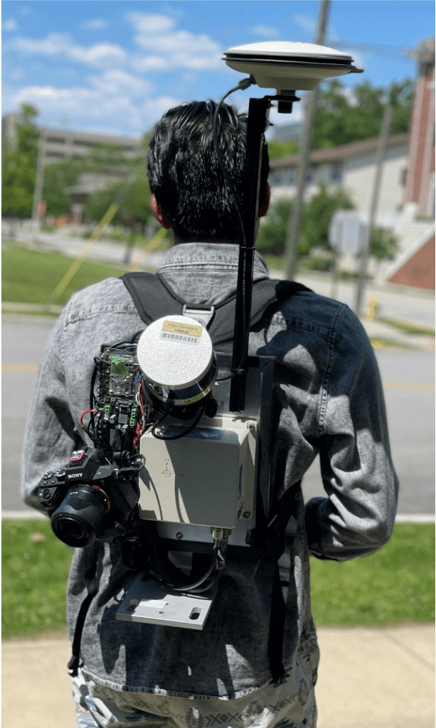
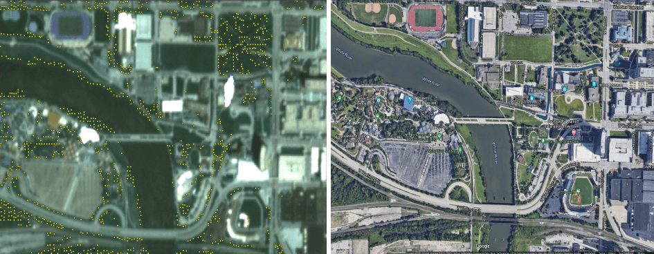
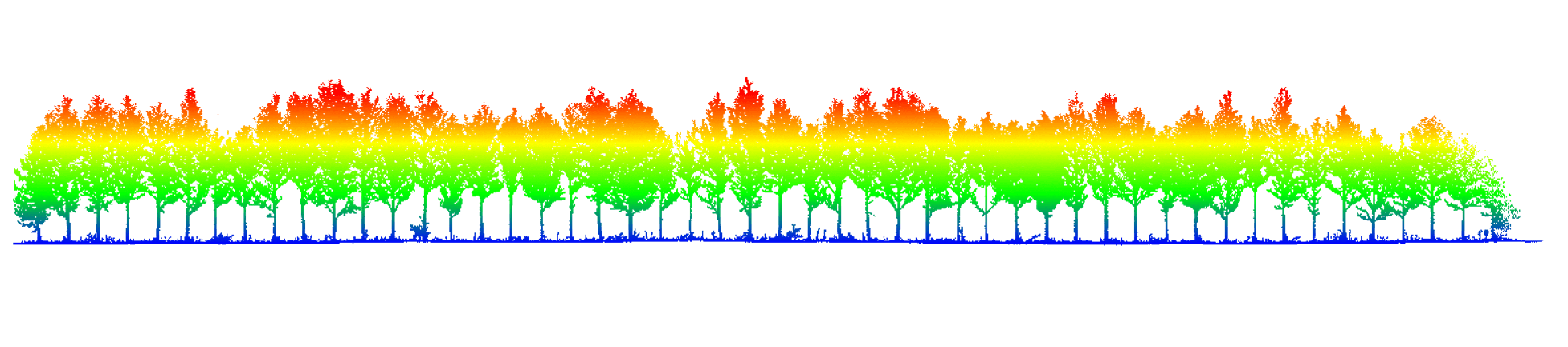
Habib's team and other research teams within the digital forestry initiative are pursuing remote and automated sensing tools that will allow thousands of forest acres to be measured and assessed in a matter of hours. Drones and backpack-mounted systems that integrate cameras with light detection and ranging, or LiDAR, sensors are being developed at Purdue.
LiDAR sensors evaluate the range between the scanning system and objects using the time it takes for the signal to travel to objects. LiDAR can be used to make digital 3-D maps of trees and forests. These maps are considered as "digital twins," a virtual representation of the forest.
"Integrating sensors on drones and backpack systems allows for the acquisition of vast amounts of data in the forest," Habib says. "In addition to building new sensing modalities and platforms, we are developing algorithms that translate the data into information and, eventually, knowledge. With the derived knowledge, the forests can be better managed to prevent forest fires, monitor disease progression and make well-founded decisions."
Daniel Aliaga, an associate professor of computer science at Purdue who is part of the digital forestry initiative, leads a team combining AI modeling with satellite and aerial based observations to generate a detailed digital model of urban forestry at city scale.
"The power provided by AI, including recent machine learning tools, can help catapult forward digital forestry to solve large-scale problems that affect us all," Aliaga says. "Developing our urban environments in unison with forestry and vegetation is necessary to keep our environment balanced, healthy and sustainable. We need powerful tools to help understand the complex bidirectional interactions between forestry and humans."
Purdue's digital forestry initiative is also developing affordable tools accessible to small landowners and forest enthusiasts.
Guofan Shao, professor of remote sensing in the department of forestry and natural resources, co-advises a team of undergraduate students from Purdue's School of Electrical and Computer Engineering to develop a handheld device using an off-the-shelf stereo camera to automatically collect and store tree stand measurements and tree-trunk diameters at different heights.
"We've developed an algorithm that can realize measurement of 1,000 trees in one hour," he says. "The hardware parts together only cost a few hundred dollars and the data are saved and easily shared and accessed. We call this technique Low-cost Optical Gaging System or LOGS."
The LOGS project is part of Purdue's Vertically Integrated Projects, or VIP program, an undergraduate-level research class. The team is working on a software program using AI to produce digital twins of the tree stand from the data the camera collects. Shao sees the potential for a smartphone app for future generations of phones equipped with stereo cameras to make the system even easier to use.
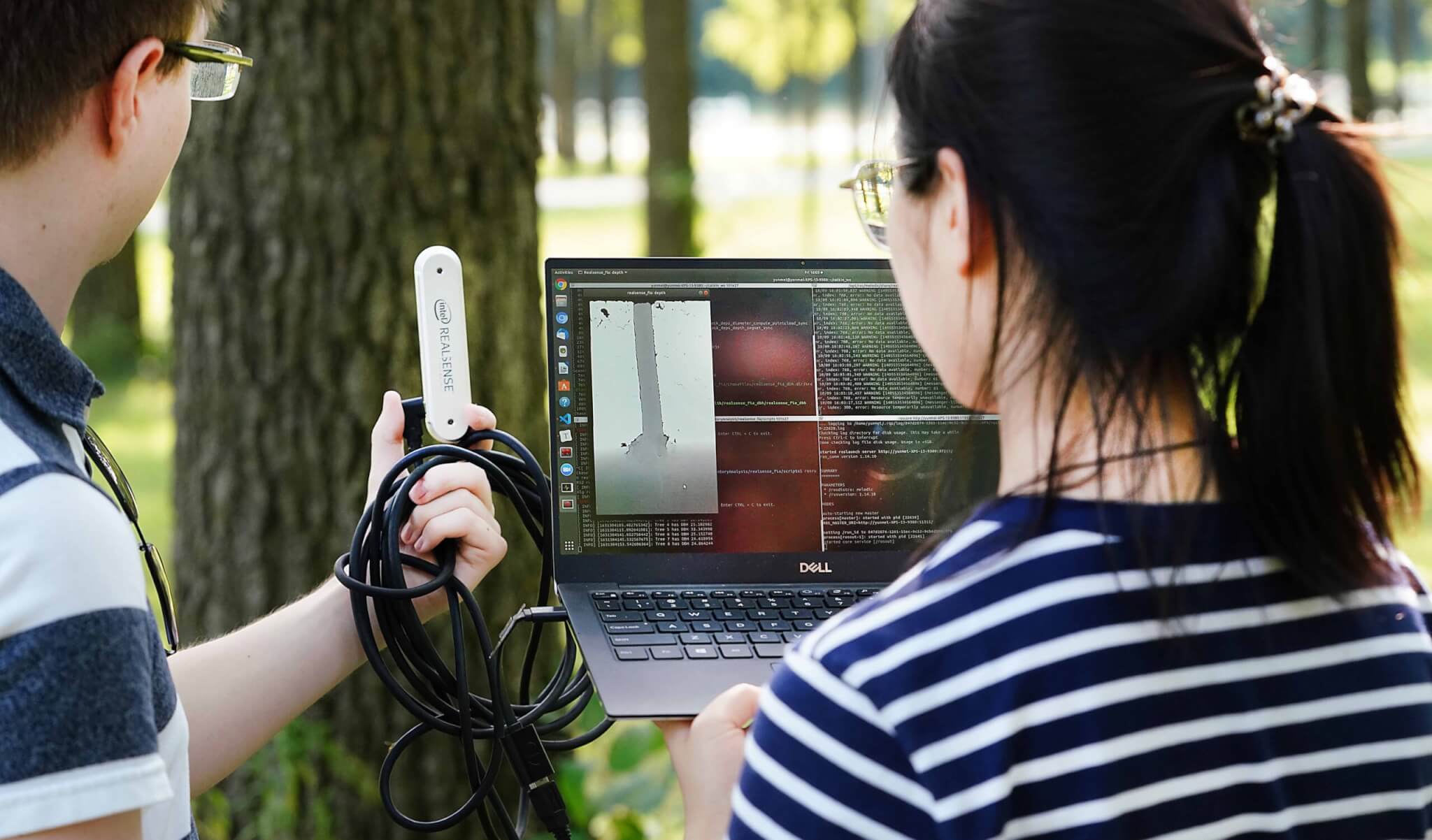 Nick John Eliopoulos (left) and Yunmei Huang (right) of the VIP program scan trees at Martell Forest. Photo taken by Tom Campbell.
 "The majority of forests in the U.S. are privately owned," he says. "Digital forestry will create tools that allow them the opportunity to manage their forests in ways previously unimaginable for a family forest landowner."
The digital forestry initiative has multiple smartphone and online dashboards in development to bring information to the public and allow anyone to better get to know the trees around them.
"In the future, I see smartphone applications enabling us to share and gather information from citizen scientists, as well as educate and entertain," Fei says. "One of the main missions of Purdue's digital forestry initiative is engagement: engagement with the public, with landowners, industry and government, and across disciplines."
Featured Stories
Animal genetics leaders at Purdue drive innovation and student success.
Ask Purdue biochemistry students in the College of Agriculture about their experience and their...

By learning how to cut through the hype and focus on what truly matters, you can shop smarter...
Channing Arndt, research professor in agricultural economics and director of the Global Trade...
Daniel Szymanski and his former postdoctoral scholar Youngwoo Lee, lead author on their paper...
The Costa Rica Rainforest Experience study abroad trip allowed students to experience the wonders...