

Yunmei Huang: Purdue’s Esri student of the year
What if? It’s a question that drives innovation, and one that inspires Yunmei Huang, a PhD student in Purdue’s Department of Forestry and Natural Resources conducting research in the Institute for Digital Forestry.
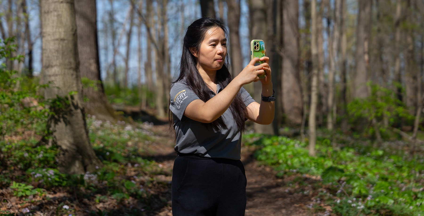
Huang’s what if began with a smartphone camera and facial identification. What if, she wondered, something similar could be developed to identify tree species?
Since that initial spark of inspiration, Huang has logged countless hours in the field and at the computer working to transform an idea into reality. Her goal is to create a cellphone-based tool that uses remote sensing, geospatial data and Artificial Intelligence (AI) to accurately identify and map trees. “Identifying tree species is a manual process for foresters or landowners,” Huang explains. The tool she’s developing would change that. “If they can use on a mobile device to capture images of tree bark and identify tree species during routine surveys, the process would be much less time consuming and costly.”
Huang’s development of this tool recently earned her a nomination for the Esri Innovation Program (EIP) Student of the Year award. She is one of about 20 students nominated for the prestigious award, which is given by Esri, a software company specializing in Graphic Information System (GIS) platforms.
“The Student of the Year award recognizes the great achievement of our students in the geospatial information science area,” says Nicole Kong, a professor of GIS and Associate Dean for Research at Purdue Libraries who nominated Huang. “There are many inspiring and exciting projects from students in different disciplines, and I was very impressed by Yunmei’s continuous efforts on her project,” Kong adds.
Huang’s began with tree bark images taken in ArcGIS Field Maps, Esri’s GIS and mapping platform, which captures the geolocation, field conditions and other data important to species identification. Using machine learning and deep learning, she then developed an AI model that could analyze tree bark images and predict tree species.
Today, with more than 6,000 images in the system, the tool can identify 21 species with 90% accuracy. Users also get descriptions of bark features and other species descriptions, which are drawn from an extensive knowledge base.
When fully developed, the tool will have the potential to do more than automate forest inventory and speed up field data collection, says Songlin Fei, director of Purdue’s Institute for Digital Forestry and the Dean’s Chair in Remote Sensing in the Department of Forestry and Natural Resources. “In the hands of students, educators, professionals and nature lovers, the tool could inspire the next generation of natural resource professionals and engage the general public in appreciating and helping nature,” Fei says.
Inspired by her own love for trees and nature, Huang began her PhD studies at Purdue in 2020, attending remotely due to the COVID-19 pandemic. She arrived on campus the following year and has become an active member of the multidisciplinary community of digital forestry students and researchers.
She knows technology is key to helping solve complex forestry and environmental issues.
Technology is the future of forestry. With it, we can better understand trees and manage forests so we can better care for them and our world.
- Yunmei Huang, a PhD student in Purdue’s Department of Forestry and Natural Resources
Featured Stories
Animal genetics leaders at Purdue drive innovation and student success.

Ask Purdue biochemistry students in the College of Agriculture about their experience and their...

By learning how to cut through the hype and focus on what truly matters, you can shop smarter...

Channing Arndt, research professor in agricultural economics and director of the Global Trade...
Daniel Szymanski and his former postdoctoral scholar Youngwoo Lee, lead author on their paper...
The Costa Rica Rainforest Experience study abroad trip allowed students to experience the wonders...