Purdue geomatics professor debuts open-source platform at upcoming NAPPN meeting
When someone wants to watch or share a video, they likely go to the free video sharing website YouTube, says Jinha Jung, associate professor of civil engineering. “Everybody knows about YouTube, and they use it. In return, what YouTube gets is centralized big video data,” he adds.
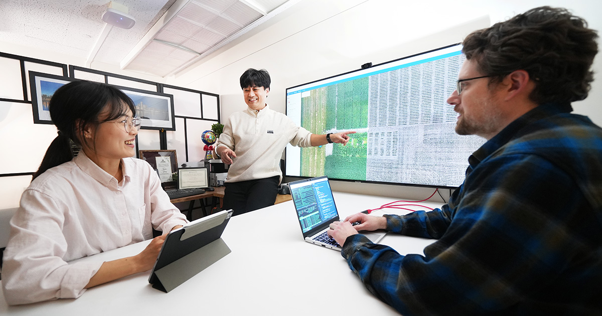
With seed money from the College of Agriculture through Plant Sciences 2.0 and the USDA’s Ag2PI: Agricultural Genome to Phenome program, Jung, whose expertise is geomatics, and his team are building Data to Science (d2s) — an online platform that initially will house data from unmanned aerial vehicles for crops and forestry.
On this website, users share drone data instead of videos.
Jung’s team will release d2s at the North American Plant Phenotyping Networking (NAPPN) conference, which Purdue is hosting Feb. 13-15. They’ll also offer a training workshop that introduces attendees to d2s and its tools for their research.
Jung’s goal is to build a community of researchers willing to contribute data. “In return what Purdue is going to get access to all those invaluable datasets from all over the world in a single place,” he says.
The d2s website — “a data-driven open science community for sustained innovation” — opens with drone footage of forests that Jung shot last year in Singapore and a map with pins marking data collection projects, including corn and soybean in Indiana, and cotton in Texas.
This is just the start, Jung says. “As everybody contributes data, you’re going to see more markers all over the nation and all over the globe. And you can access each of this data from here directly.”
Jung, who completed a PhD at Purdue, based d2s on an online hub he created as a faculty member at Texas A&M, Corpus Christie. When he returned to Purdue to join the civil engineering faculty in 2019, he wanted to develop an open-source version of the earlier platform with free access and collaboration among multidisciplinary users. His colleagues in plant sciences and digital forestry were enthusiastic about the idea.
Jung’s team built the frame — “all those core capabilities, how to move the data, how to manage the data, how to share the data with others and how to visualize it,” he explains. “The people who will make contributions will be the actual users of the platform.” For example, a research group may want to do a certain analysis but doesn’t want to deal with saving, managing and visualizing big data. They could build an application in d2s, and in turn, would add their new source code to the platform.
“The good thing about this is in its open nature,” Jung says. “Users can customize in a way they want to use it. Everybody can use it for free, but if they develop something new using this foundation, they’re going to be the one contributing back to the community so somebody else can use that as well.”
d2s aligns with White House Office of Technology and Policy mandates on openness in scientific enterprise that requires federally funded projects to make research and supporting data “clearly, immediately and equitably disclosed to the public at no cost.”
Following the FAIR principle — making the data findable, accessible, interoperable and reusable — will extend its usefulness from agriculture and forestry to other fields, Jung says. It could also level the playing field for scientists without resources for costly commercial data.
“There is a big team working on this,” he says, crediting colleagues from different disciplines with helping to make the d2s website user-friendly and intuitive. The release of its initial version at the NAPPN meeting gives his team a chance to interact with potential users and make improvements based on their feedback.
While year 1 of the project focuses on drone data, year 2 will add field sampling data and integrate phenotypic information from the Ag Alumni Seed Phenotyping Facility. Jung also is working on proposals for federal funding to expand the platform’s scale.
“We are going to keep developing this open-source community to provide services to the research institute and to developing countries so we can help them start to use this kind of technology for their science,” he says.
“Eventually, let’s say in five years, whenever somebody says, ‘I need to deal with drone data, where do I go?’, like videos on YouTube, they can go to the d2s.”

