

Assessing global biodiversity with ears to the ground, NASA eyes in the sky
Purdue University Professor Bryan Pijanowski’s research team will be working in some wild and remote places around the globe in the coming year.
Pijanowski’s sound-source surveyors will be equipped with microphones, headphones, and parabolic reflectors to efficiently collect sound waves from the natural world. Their tools also include low-flying drones and sensors mounted on orbiting satellites and the International Space Station.
The Purdue team is utilizing these resources to develop a global model of animal and plant diversity and how it changes. They will also access Purdue’s two crown jewels of global biodiversity databases. One is the Global Forest Biodiversity Initiative, a database that holds tree species inventories from more than a million plots of land. The other database, at the Center for Global Soundscapes, contains more than four million audio recordings from most ecosystems on Earth.
“We’re using acoustic remote sensing to develop the animal biodiversity model,” said Pijanowski, center director and professor of Forestry and Natural Resources. He has, for example, maintained an acoustic sensor in the wetlands of the Purdue Wildlife area since 2007. And from the Southeast Asian Island of Borneo alone, he has over 25,00 recordings that include sounds from 3,000 animal species.
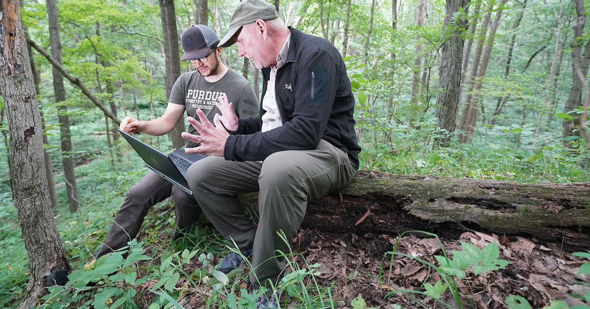 Photo credit: Purdue University/Tom Campbell
David Savage, Ph.D. candidate (left) and Bryan Pijanowski (right), Professor, both of the Department of Forestry and Natural Resources, look over a map of the study area displayed on the project’s field laptop.
Photo credit: Purdue University/Tom Campbell
David Savage, Ph.D. candidate (left) and Bryan Pijanowski (right), Professor, both of the Department of Forestry and Natural Resources, look over a map of the study area displayed on the project’s field laptop.
The highly transdisciplinary work requires expertise in ecology, social sciences, engineering, statistics and the humanities. Project co-leads include Purdue’s Kristen Bellisario, clinical assistant professor in the John Martinson Honors College; Jinha Jung, assistant professor in the Lyles School of Civil Engineering; and Jingjing Liang, associate professor of Forestry and Natural Resources.
The NASA project specifically focuses on developing plant-animal diversity models for four different types of forested ecosystems. The work starts in the deciduous forests of nearby Tippecanoe County. Pijanowski’s team uses the area as its “sandbox” where they go for research training and protocol development. The other three sites are located in Tanzania’s Miombo Woodlands, Mongolia’s savanna and forest-steppe ecosystems, and the mangroves of the Sundarbans UNESCO World Heritage Site in Bangladesh.
“The Miombo Woodlands is one of the largest forest ecosystems in the world,” Pijanowski said. “The Sundarbans is the location of one most pristine mangrove sites in the world. Mangroves and estuaries are under great threat from climate change due to rising sea levels. And Mongolia represents a mixture of coniferous forests and grasslands which are also threatened from climate change.”
The project will extend the biodiversity models of all four ecosystems to other long-term studies in Borneo, Southeast Asia; Costa Rica, the Caribbean; Finland, northern Europe, and Patagonia, South America.
The Purdue team’s multiple data-collection platforms include three experimental sensors onboard the International Space Station.
“These are experimental sensors to map and create plant habitat models that we then calibrate with all the measurements we’re making on the ground and with unmanned aerial vehicles,” Pijanowski said. The space station’s Global Ecosystem Dynamics Investigation (GEDI), uses light detection and ranging (LiDAR). The DLS (German Aerospace Center) Earth-Sensing Imaging Spectrometer (DESIS) is a hyperspectral sensor that detects species composition and diversity spanning electromagnetic frequencies from visible light to infrared. And ECOSTRESS, a thermal sensor, detects the drought stress condition of plants.
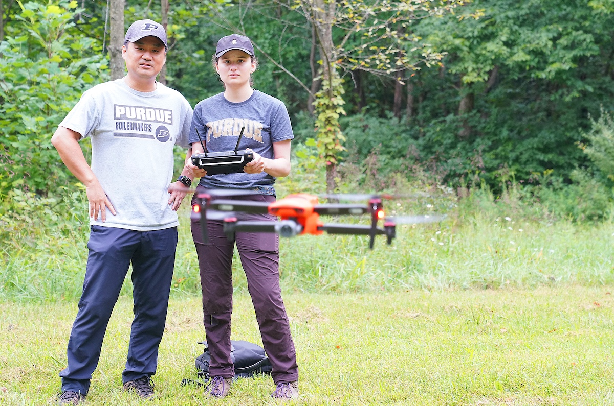 Photo credit: Purdue University/Tom Campbell
Samantha Lima, Ph.D. student in Ecological Sciences and Engineering, operates a drone with Jinha Jung, assistant professor of Civil Engineering.
Photo credit: Purdue University/Tom Campbell
Samantha Lima, Ph.D. student in Ecological Sciences and Engineering, operates a drone with Jinha Jung, assistant professor of Civil Engineering.
Two satellite systems complement the space station sensors. These are the Moderate-Resolution Imaging Spectroradiometer (MODIS) and Landsat, which detect fires in Tanzania that affect the habitat of chimpanzees, bushbabies, monkeys, and baboons.
With these three space station sensors, the team gleans data on a habitat’s structural complexity, species diversity, and stress, which mesh with the global tree dataset.
Drones flying 80 meters above the ground provide high-resolution data (one-centimeter pixels) that allow the researchers to calibrate with the space station data. The team also conducts plant surveys at each location.
Jinha Jung and his geospatial data science group handle calibrations and linkages between ground-based, airborne, and spaceborne data.
“We need to be able to relate the images we get to specific locations that Bryan is visiting and recording sound to quantify biodiversity,” Jung said. “We can generate very high-resolution 3D models of those locations.”
One task of Jung’s group is to fill the gaps in the space station’s LiDAR coverage. Orbiting at an average altitude of about 400 kilometers (nearly 250 miles), and moving at 17,500 miles an hour, the space station bounces the GEDI laser beam off the Earth’s surface at intervals of about 70 meters.
Jung’s group also will create 3D models of all the NASA biodiversity field sites, and make the 3D models available on the project website (https://hub.digitalforestry.org/nasa_biodiversity/). The models will allow users to point and click on a site, zoom in, and rotate the view in three dimensions.
“We’re going to embed recordings so visitors can visualize the site in 3D, but they can also hear the sound, almost feel like they’re actually there,” Jung said.
The NASA biodiversity project is part of Pijanowski’s mission to record the Earth. His chorus4nature.org website connects to his entire database of global biomes, the various natural habitats plants and animals make their home.
“People can look at all of our sites in the maps of locations where we have studies,” he said. “We describe all the biomes, all the different studies, the threats to the biomes. We have a photo catalog of all the sites and videos talking about the sites and what we’re doing there as scientists in action. Ultimately, we are trying to use the very best technology to solve some of society’s grand challenges of species loss and climate change. Being supported by NASA makes this especially part of being a Boilermaker, Purdue is the cradle of astronauts. Perhaps, with NASA’s help, we will be the cradle of solving global biodiversity challenges.”
Featured Stories

For Brody Cox, preparing for the Indiana State Fair began long before he entered the show...
Carolyn Foley, a long-time member of the Purdue Forestry and Natural Resources (FNR) and...

In the September Purdue University/CME Group Ag Economy Barometer survey, 52% of respondents...

Purdue University’s College of Agriculture recognized nine alumni at the Distinguished...
Keep your eyes peeled across Indiana for the newly minted Purdue Forestry and Natural Resources...

“Being at Purdue has changed my thinking entirely,” says Mingyu Zhao, a third-year...