Digital Horticultural Crop Activity Records
Operations records (who, what, where, how) are those elements of records and data that are often missing when we try to analyze what happened during a growing season. They have value from several perspectives. Unfortunately, most farms use a notebook or assorted formats of records that are incomplete and rarely digital. A digital format allows sorting, aggregation and analysis (by zone/bench/block/field, crop, machine, person, product, etc.) in a much easier manner. A template (or example database for you to duplicate) was assembled so you can obtain and keep these records digitally in a simple manner.
![]() This template is based on Airtable, which is a cloud database platform that offers free services plus additional features for a fee. We believe it will be a rare instance for your Field Records to require the paid level of service.
This template is based on Airtable, which is a cloud database platform that offers free services plus additional features for a fee. We believe it will be a rare instance for your Field Records to require the paid level of service.
Don’t let “database” scare you … these are just lists, essentially.
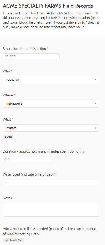
Since many are new to Airtable and may be also new to the digitizing records of field activities records, we have generated a series of five short (less than 45 minutes total!!) videos that walk you step-by-step through the process of getting the templates, customizing them to your own needs, and getting your reports downloaded to your own computer. We encourage you to watch part 1 which demonstrates the simple forms (like the one illustrated here) and illustrates the types of records you will have. You will see that the reporting can readily be done on a smart phone (or computer) literally in seconds. If that seems applicable to you, and we believe many will find this to be true, parts 2-5 explain all you need to know to have streamlined, digital, and private yet sharable records that are personalized for your operation.
You will want to watch these training sessions in the proper order the first time for them to make the most sense. You may want to refer back to particular section as you duplicate and deploy this template for your operation. Be aware that this set of 5 videos will not cover all features of Airtable, but will cover all you need to know to take the Horticultural Crop Activity Records template we have assembled and customize it for your operation.

Part 1: Brief demonstration of Airtable forms and results (10:20) | https://youtu.be/amIS1qliII8
Part 2: Copying templates and controlling access (8:23) | https://youtu.be/EbjEf4UDlJ8
Part 3: Explanation of some Airtable features built into the template (7:07) | https://youtu.be/luFc1YtpdME
Part 4: Customize your lists and share your form (8:50) | https://youtu.be/K9A6ct_W7Hw
Part 5: Export your data (8:11) | https://youtu.be/-GotLX9pYQ8
This set of videos does not explain all that Airtable can do. And we did not cover the wonderful feature of syncing your Airtable database to a GoogleSheet. But if you do that, you can pretty quickly analyze and aggregate with Pivot Tables or with basic list and data actions like sorting, and filtering. As covered in part 5, you will be able to export your data as csv and bring it into your software of choice for other analysis.
Finally … here is the link to the database template. After viewing those orientation/training/demonstration videos, you should be able to duplicate, then customize and deploy this for your operation.


