

Forestry & Natural Resources
Agricultural Research and Graduate Education
Forestry & Natural Resources
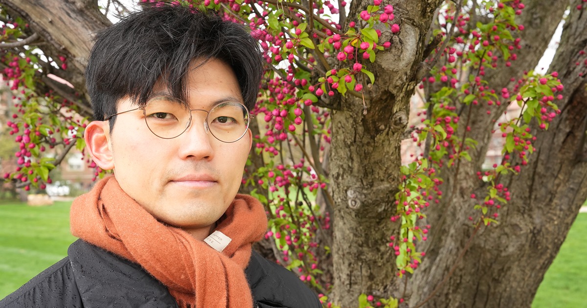
Hunsoo Song, the civil engineer who speaks (in algorithms) for the trees
Fire, metal, water, earth and wood. In South Korean tradition, these five elements explain personalities, relationships and even material properties. Being close to each element and balancing them in your life can bring you harmony, and Hunsoo Song learned from a fortune teller that his birthday and name left him lacking and in need of a connection to wood.
Despite most of his work being done on a computer, Song was recently published in Sustainable Cities and Society for research directly applicable to the outside world — and wood — though his work within the Institute for Digital Forestry while he was earning his PhD in civil engineering from Purdue.
"I grew up in Seoul, South Korea, which is a huge city, so it was very natural to get interested in urban phenomena and urban problems,” Song said. “I remember there was a very hot summer in South Korea at the same time as I began my master’s program, so I saw the potential of research in the urban heat island problem.”
Urban heat islands are caused by the built infrastructure of cities. Buildings, roads, cars and sidewalks absorb and retain heat. Some human activities, like the use of cars and air conditioners, become more concentrated in a city, also increasing local concentrations of greenhouse gases and further warming the area.
Experiencing Seoul through that heat inspired Song’s interest in trees. These woody plants provide crucial ecosystem services, or benefits for wildlife and humans. With tall canopies that lay shade and root systems that pull water from the ground up through their trunks and leaves, trees reduce the heat of an area. When planted in cities, they can combat the urban heat island phenomena.
Song said, “We know that urban heat can be mitigated by planting trees, but we don't know the precise contribution of trees in a quantifiable measurement. It is really important for us to find a way to quantify their precise contribution so that urban planners and governments can make more effective decisions.”
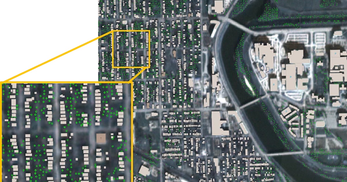
That’s where Song’s specialization in algorithms and geomatics, or mapping, comes into play. He uses aerial LiDAR technology that sends laser pulses from a plane to the ground and measures the time and reflection angle of the pulse as it returns. Combined with data he gets from a satellite that gives him information on color, Song builds three-dimensional maps of landscapes.
By building these digital depictions of Dallas, Texas — the largest inland metropolitan area in the U.S. — Song was able to calculate the percentage of tree coverage in different urban environments and compare their temperatures using data from the ECOsystem Spaceborne Thermal Radiometer Experiment on Space Station (ECOSTRESS).
 Song built three-dimensional maps of Dallas, Texas, with algorithms that could tell the difference between buildings (red), ground (gray and brown), water (blue) and vegetation (green). He separated the urban neighborhoods into tiles and grouped those tiles based on how much tree coverage they had.
  Song found that the areas with greater tree coverage were cooler than the rest of the city. With every 10% increase in tree coverage, the urban residential area experienced a decrease in land surface temperature by about 0.5 degrees Celsius, or approximately 1 degree Fahrenheit.
 “Typical residential areas in Dallas have low tree coverage, like 10% to 20%. Their land surface temperatures are higher than the city average by 0.8 degrees Celsius. For other types of residential areas that have much more tree coverage, like 40% to 50%, their land surface temperature is lower than the city average by 0.7 degrees Celsius,” Song said.
Rising temperatures are a major concern with climate change. Although trees’ impact may seem minimal with a total difference of about 1.5 degrees Celsius in land surface temperature, that is the same number that researchers have benchmarked for irreversible change and catastrophic risks to the environment. Song’s research shows that planting trees in the most densely populated areas could mitigate some of the warming effects. Trees planted in more sparse regions also reduced the urban heat island phenomena, to a lesser extent.
“The importance of Hunsoo’s work lies in his approach being scalable and explainable,” Jinha Jung, associate professor of civil engineering and Song’s principal advisor, said. “His algorithm is transferable to a new location where no training data are available because his approach does not rely on training datasets. In addition, I believe the outcome from his approach will have a great impact on the geospatial artificial intelligence community because it can serve as training data to develop data-driven artificial intelligence models.”
This research, funded by the National Geospatial-Intelligence Agency, is new, and there is a lot more to discover. Song wonders how his algorithms could be applied in areas without access to aerial LiDAR data and whether or not different tree species in different seasons would change the cooling potential of tree coverage. Perhaps measuring air temperature instead of surface temperature would alter the results, too.
For Song, trees are important beyond their impact on the climate. His work in digital forestry finally brought him closer to wood, as the fortune teller once advised, and he enjoys spending his leisure time in forested areas and finding balance through connecting with nature. After completing his PhD degree at Purdue in 2024, Song began post-doctorate research at the Yale School of Environment, where he continues to use geospatial data to advise the development of more sustainable, livable cities.
Approved for public release, NGA-U-2024-09405.
Related Posts

Forestry & Natural Resources
Meeting the wildfire threat with digital models of the real world — 13 May 2026

Forestry & Natural Resources
Fellowship helps natural resources professionals build digital skills — 22 April 2026
Featured Stories
Behind the Research: Jackie Getson
Jackie Getson, project manager for Purdue’s Institute for Digital Forestry, has built a...

Brady Hardiman named 2026 University Faculty Scholar for bringing communities and trees together to grow better cities
Brady Hardiman, associate professor of forestry and natural resources and sustainability...

Meeting the wildfire threat with digital models of the real world
Many of the 60,000 wildfires occurring annually across the U.S. flare up in the intersection...

Fellowship helps natural resources professionals build digital skills
Digital tools are transforming how forests and natural resources are managed. A new fellowship...
Digital forestry team combines AI with satellite data to monitor urban trees
A Purdue University digital forestry team has created a computational tool to obtain and analyze...
Digital foresters embrace GIS mapping and analysis
Purdue University has grown a thriving forest of more than 2,000 geographic information systems...
This research is a part of Purdue’s presidential One Health initiative, which involves research at the intersection of human, animal and plant health and well-being.