

Purdue Researchers Use 3D Printing to Make Open-Source Alternative to Costly Groundwater Sensors
A plume of contamination spreads underground. A building's foundation weakens. A wetland mysteriously loses water. All three scenarios need the same technology: sensors that track how groundwater flows beneath the surface – devices so specialized and expensive that the U.S. Geological Survey (USGS) owns just a few.
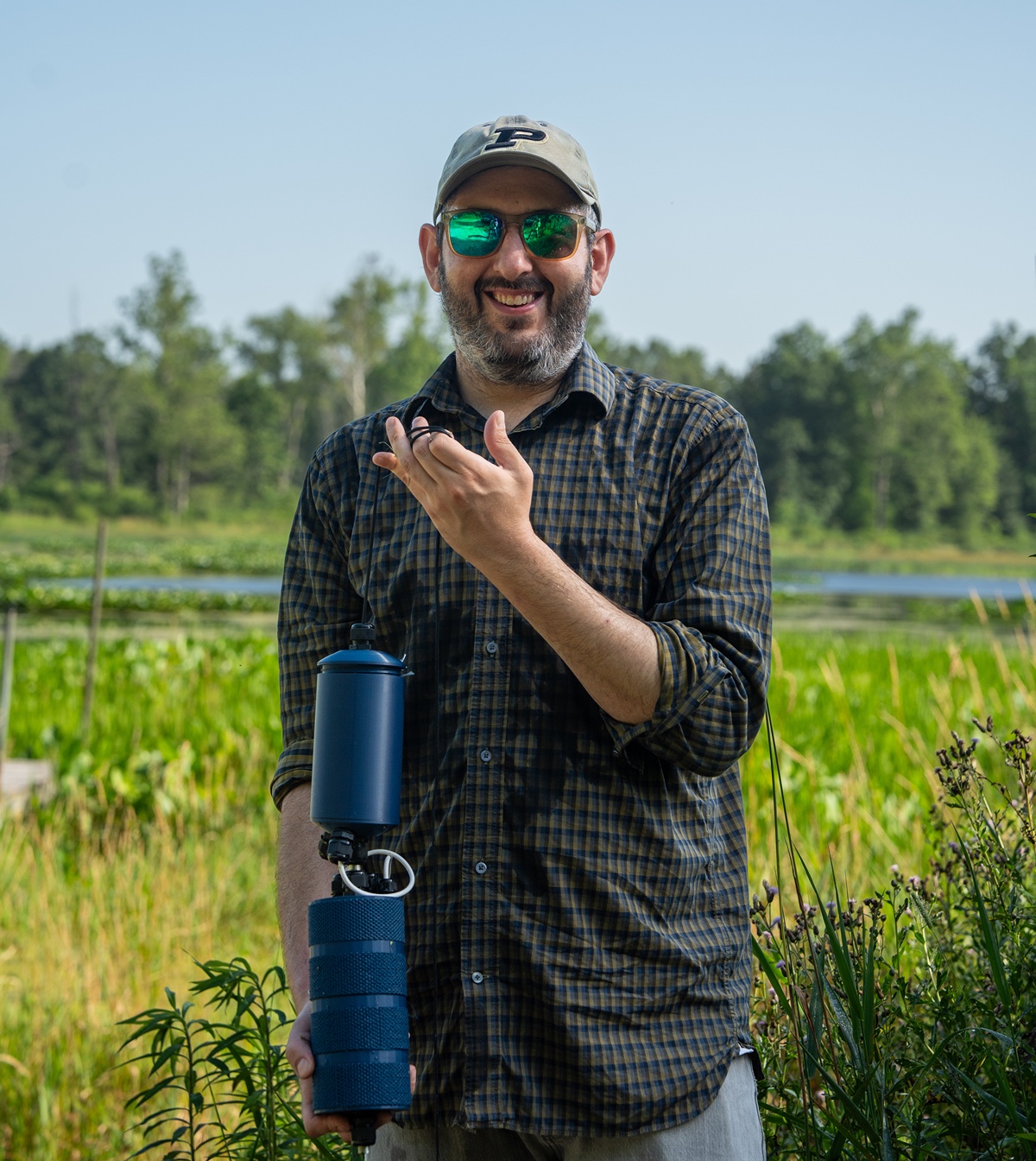 Jacob Hosen, assistant professor of internet-of-things and ecological analytics in the Department of Forestry and Natural Resources at Purdue University's College of Agriculture, is using 3D printing to create an affordable, patent-pending alternative.
As a contributor to River Restoration Intelligence and Verification , an organization dedicated to developing affordable environmental monitoring technologies, Hosen had both the network and the philosophy to reimagine how the sensors could be built.
He and his team designed the new sensors from the ground up. Circuit boards with arrays of temperature sensors track both the speed and direction of groundwater, housed in 3D-printed cases that can be produced and iterated directly in the lab.
A big part of designing an accurate sensor is creating a housing that won't disrupt the water flow," Hosen explained. "We're 3D printing textures that will recreate the soil environment, so the water flows through the sensor in the same way it flows through the ground.
Affordability and accessibility are central to the production process. Working with a few U.S.-based vendors for manufactured components like circuit boards, the team handles the rest in the lab with a 3D printer and a specially modified toaster oven.
"We can make all of this with just a few vendors in the U.S., and then do the rest of the assembly in-house for just a few hundred dollars a unit," Hosen said. "That's not something you can do in most ecology labs."
This project and Hosen's other sensor development work give students hands-on experience with manufacturing techniques typically reserved for engineering labs. Graduate and undergraduate students learn skills like circuit board assembly, 3D printing and prototype iteration.
"It's a useful proof of concept of a different way of building these types of devices," he said.
Initial durability testing showed promise: the devices operated continuously underwater for seven to eight months without failure. If successful at scale, they could become standard long-term deployments in USGS wells, designed for months to years of continuous operation.
The new sensors can transmit data wirelessly using LoRa networks established by Agriculture IT while also storing data locally as a backup, ensuring no information is lost when monitoring remote areas. Purdue's expanding network coverage supports on-campus testing of the device's telemetry.
"In a university setting, aligning infrastructure with research needs is challenging," Hosen said. "We've done that successfully here, and we should be proud of that."
The first major field test will take place at a USGS site along the Kankakee River near the Illinois border. Additional devices will be deployed at Purdue’s ACRE Wetland to study hydrology.
The project brought together expertise from multiple institutions. Hosen developed the concept with Zaven Arra, lead engineer at River Restoration Intelligence and Verification. Keith Cherkauer, professor of agricultural and biological engineering and director of the Indiana Water Resources Research Center, served as co-principal investigator at Purdue. Funding was provided by the USGS Next Generation Water Observing System.
The team is seeking a patent – not for profit, but to keep the design open-sourced, a strategy that aims to make the devices accessible to anyone who needs them. Hosen has disclosed the innovation to the Purdue Innovates Office of Technology Commercialization, which has applied for a patent to protect the intellectual property.
Hosen sees applications for the sensors across sectors: tracking contaminated groundwater for the Department of Defense, monitoring water consumption by data centers, assessing building stability in waterlogged conditions and studying subsurface water flow in wetlands.
"It works anywhere that water moves underground," Hosen said.
Featured Stories
Carolyn Foley, a long-time member of the Purdue Forestry and Natural Resources (FNR) and...

In the September Purdue University/CME Group Ag Economy Barometer survey, 52% of respondents...
Purdue University’s College of Agriculture recognized nine alumni at the Distinguished...
Keep your eyes peeled across Indiana for the newly minted Purdue Forestry and Natural Resources...
“Being at Purdue has changed my thinking entirely,” says Mingyu Zhao, a third-year...
Senior wildlife major Madison Medley spent her summer as a natural resource intern with Hamilton...