

Purdue launches new AI-based global forest mapping project
Purdue University’s Jingjing Liang has received a two-year, $870,000 grant from the World Resources Institute to map global forest carbon accumulation rates.
“To accurately capture the carbon accumulation rates of forested ecosystems across the world has always been a challenging task, mostly because doing so requires lots of ground-sourced data, and currently such data are very limited to the scientific community,” said Liang, an associate professor of quantitative forest ecology and co-director of Forest Advanced Computing and Artificial Intelligence Lab.
“This task is considerably more challenging than mapping carbon emissions from forest loss,” said Nancy Harris, research director of the Land & Carbon Lab at the World Resources Institute, a nonprofit research organization based in Washington, D.C. “With emissions, there’s a clear signal in satellite imagery when trees are cut, leading to a big drop in forest carbon stocks and a relatively abrupt pulse of emissions to the atmosphere. With sequestration, forests accumulate carbon gradually and non-linearly.
“Even the most advanced satellite sensor can’t capture this reliably on its own, especially in older forests where the signal saturates. A forest stops getting taller long before it stops accumulating carbon,” she said.
Forest carbon accumulation rates are sensitive to the subtle changes in three forest growth components: ingrowth, upgrowth and mortality. Ingrowth represents the number of small seedlings that have attained a specific threshold size to be called trees. Upgrowth is the gradual increase in diameter of trees through the process of photosynthesis. Ground-sourced forest inventory data measured at multiple points in time currently is the only reliable source of information for accurate quantification of these three forest growth components.
“To date, people have never been able to estimate the ingrowth, upgrowth and mortality rates of individual forest stands at a global scale. This information gap leaves huge uncertainty in the size, location and trend of global forest carbon sink,” Liang said.
Liang is developing an artificial intelligence model that will combine information collected about billions of trees measured on-site with satellite and other geospatial data to map local forest growth rates throughout the global forest range.
 The new World Resources Institute project at Purdue will draw upon the massive ground-sourced forest inventory data with remeasurements, collated by Science-i and the Global Forest Biodiversity Initiative. (Credit: Javier Garcia-Perez)
 “This will be the first AI-based forest growth model deployed at a global scale,” he said. Beyond accurately quantifying carbon dynamics, Liang’s AI-based forest growth model will also capture the dynamics of forest biodiversity and timber quality.
“We’re excited to support the growth of this research collaboration,” Harris said. “The spatially granular data this new project will provide will help us better understand the role our planet’s forests play in local, nature-based solutions to mitigate global climate change. The inclusive and globally-networked approach of this initiative is at the heart of the mission of WRI’s Land & Carbon Lab.”
Developing such a model requires massive computing power and comprehensive global data coverage. The state-of-the-art high-performance computing clusters at Purdue will provide sufficient computing support. Still, achieving comprehensive global coverage of ground-sourced plot data remains a challenge, particularly in tropical countries.
“The data from these countries have been limited historically,” Liang said. “Through the newly established network of Science-i and its sister consortium, the Global Forest Biodiversity Initiative, we already have working relationships with a large number of scientists across the world who are collecting and sharing those data.”
Liang founded Science-i, a web-based collaboration platform involving more than 300 scientists around the world. He also co-founded the Global Forest Biodiversity Initiative, which has built a database of 1.3 million sample plots and 55 million trees. That database will serve as the project’s basis.
“We are going to collect much more data, especially from the global south, to fill those data gaps,” Liang said. “We will get more people involved, especially those from underrepresented groups.”
Collaborators of this project already include representatives of Indigenous groups across North America, Amazonia, Africa, and elsewhere. Rural communities, forestry practitioners, and citizen scientists will also become project collaborators.
“We co-produce the knowledge based on the FAIR principle of global collaboration—findable, accessible, interoperable, and reusable,” Liang said.
“In Science-i, everyone collaborates with each other as equal partners on all projects. We openly share our findings with transparent real-time discussions across the whole team. Then we cross-evaluate and consolidate our research findings at the end. This is a brand-new way to do international collaborative forest research.”
The extensive global partnership and comprehensive forest tree database created from this project will complement Purdue’s Digital Forestry Initiative, which seeks to leverage technology and multidisciplinary expertise to measure, monitor and manage urban and rural forests.
Liang is co-lead, with Ximena Bernal, associate professor of biological sciences, for the Biodiversity Research Community, part of Purdue’s recently launched multi-disciplinary Institute for a Sustainable Future.
Land & Carbon Lab (LCL) is the World Resources Institute’s premier hub for geospatial data, analysis, and monitoring of the world’s land and its natural ecosystems. Its data and monitoring solutions, which include the Global Forest Watch platform, exist to help accelerate implementation and financing of nature-based solutions to climate change worldwide. LCL offers: (1) innovation in open geospatial data for land and carbon monitoring, (2) spatial intelligence to support nature-based solutions policy and target tracking, and (3) tailored tools that help businesses, governments, civil society organizations, and local communities make data-driven decisions. LCL collaborates across WRI and its network of external partners to transform big geospatial data into action and impact. www.landcarbonlab.org www.globalforestwatch.org www.wri.org
(Banner image credit: Radomir Balazy)
Featured Stories
Trask is writing a new narrative about rats, birds and people as he pursues his doctorate in...
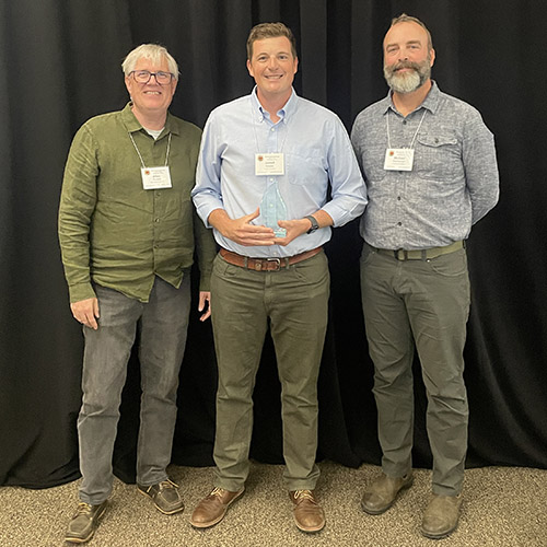
Several Forestry and Natural Resources students, staff and recent alumni have been recognized for...
A plume of contamination spreads underground. A building's foundation weakens. A wetland...
Jarred Brooke, Extension wildlife specialist, was honored with a Career Achievement Award at the...
Sophomore forestry major Brett Cox recaps week 2 of the Sustainable Natural Resources study...

Morgan Hamilton, a rising senior majoring in aquatic sciences, has had an...