

Digital forestry can help mitigate and prevent wildfires
ONE HEALTH | DIGITAL FORESTRY
Purdue Institute for Digital Forestry calls upon university wide collaborators to meet this goal
The National Interagency Fire Center reports as of this writing that 19,444 fires have burned 2,161,787 acres in the United States alone. Land managers and governments are waging a high-stakes battle against decades-long wildfire increases. Technology can play a critical role in extinguishing that threat, according to researchers at Purdue University’s Institute for Digital Forestry.
“With digital technology, my colleagues and I can study every tree, from root to canopy. We conduct field mapping of wildfire risks at a scale that provides critical and actionable information,” said institute director Songlin Fei, who also holds the Dean’s Chair in Remote Sensing.
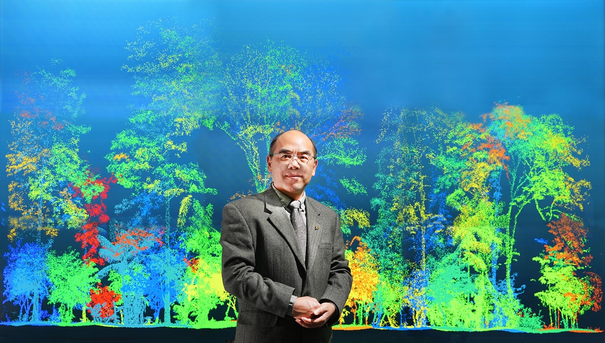 Purdue Institute for Digital Forestry director Songlin Fei in front of a screen that displays a digital forest created from the remote sensing taken by his collaborators.
 Using digital forestry, researchers can identify the areas of highest risk that affect large populations and valuable infrastructure. Purdue’s efforts include developing innovative remote sensing technology, from drone to satellite, to determine the probability and magnitude of wildfires at a given location.
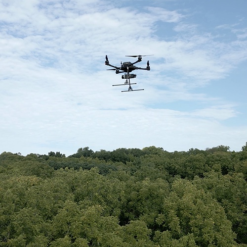
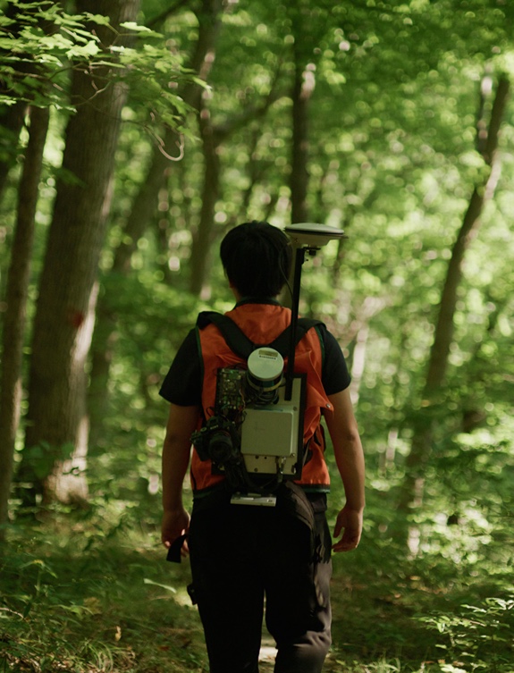 Ayman Habib, the Dr. Thomas A. Page Professor in Civil Engineering, leads a team that has integrated medium-altitude, near-proximal and proximal sensing technologies on board crewed aircrafts, uncrewed aerial vehicles and even wearable backpacks for the acquisition of RGB/thermal imagery and LiDAR (light detection and ranging) point clouds in forests.
“We are also working on developing data analytic strategies for modeling the forest floor together with the detection of woody debris and description of the underlying layer of young and short species of trees, shrubs and soft-stemmed plants,” said Habib.
Aeronautics and astronautics professor James Garrison and his team recently released a satellite named SNOOPI (SigNals Of Opportunity: P-band Investigation) from the International Space Station for a proof-of-concept mission. SNOOPI is the first in-space demonstration to see if powerful satellite transmissions can be reutilized as illumination sources from noncooperative communication satellites for Earth remote sensing.
“The amount of biomass above the surface and the water contained in vegetation are theoretically measurable from SNOOPI’s observations,” said Garrison, whose team at Purdue, NASA’s Jet Propulsion Laboratory and NASA’s Goddard Space Flight Center built SNOOPI. “These variables, along with the soil moisture, are critical for predicting the risk of wildfires.”
The institute has formed partnerships around the world to conduct research, increase awareness of digital forestry’s capabilities and share expertise and operates a multimillion-dollar portfolio of programs in collaboration with various public, private, academic and nonprofit organizations. One project, for example, helps landowners and stakeholders to better adapt their forests to increasingly complicated economic and climatic conditions in the eastern U.S.
The digital forestry team’s packed agenda includes developing more accurate methods for measuring and monitoring carbon as a way to mitigate climate change. To augment sustainable forest management, the team’s digital maps also improve logistics that lead to better understanding of timber quality and quantity, which enhances profitability, Fei explained.
Institute researchers are creating “digital twins” — digital copies of forests — to obtain critical insights into their ecology. These digital twins allow detailed fire modeling and simulation, along with visually engaging public outreach and education.
Bedrich Benes, professor of computer science, leads the computational vegetation group that focuses on forest reconstruction and building digital twins of plants at their functional level. Working with his collaborators and graduate students, he plans to use the 3D tree volumetric digital twins to replicate large-scale forest fires.
“Forest fires are often simulated on the scale of individual trees, and that does not capture their internal structure. We want to bring it to the level of individual branches and leaves,” said Benes.
 Bedrich Benes and his colleagues created this model showing the intricate branching structure of a mature acacia tree using their Interactive Invigoration framework.
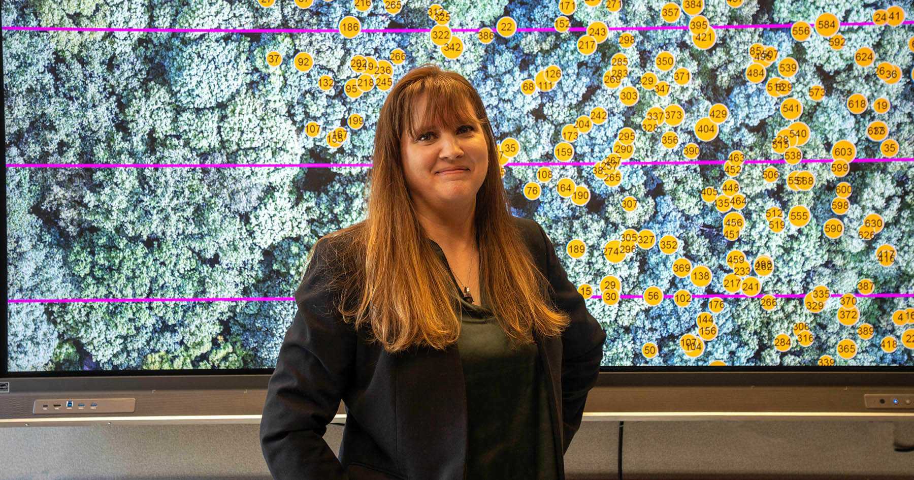
 Michael Jenkins, professor of forestry and natural resources, and Jinha Jung, associate professor of civil engineering, have an ongoing project to quantify forest fuel characteristics in Tennessee’s Great Smoky Mountains National Park.
“We’re hoping to use some of the digital forestry techniques that have been developed, especially with LiDAR, to look at the vertical and horizontal distribution of fuels to see how it may or may not aid the spread of fire,” Jenkins said.
In addition to collecting and analyzing data and improving the resolution of digitally derived data, “You have to look on the ground and understand what it means ecologically,” said Jenkins, who spent 10 years as a national park ecologist in the Smokies before joining the Purdue faculty in 2008.
“We’re particularly interested in some of the evergreen shrubs that occur in the southern Appalachians and to parse out the height, the cover and potentially the species of those shrubs,” Jenkins said. These shrubs can serve as “ladder fuel,” changing a low-intensity surface fire into something far more intense, fast-moving and dangerous, especially with climate change altering the occurrence and intensity of droughts.
Human encroachment into natural areas raises questions about insurance and how to protect homes, and homeowners, with more astute fire management. The 2016 Chimney Tops 2 Fire that burned nearly 18 square miles in Tennessee, resulting in 14 deaths and millions of dollars in damages, demonstrated what can happen when a relatively large human population resides in the wildland urban interface of the southern Appalachians.
That a fire could spread so widely and burn with such intensity during the fall was unprecedented. “It wasn’t a summer drought occurrence. It was during the dormant season,” Jenkins said.
Yet another institute collaboration between Daniel Aliaga and Aniket Bera, both associate professors in the Department of Computer Science, will apply digital technologies to urban fire analysis.
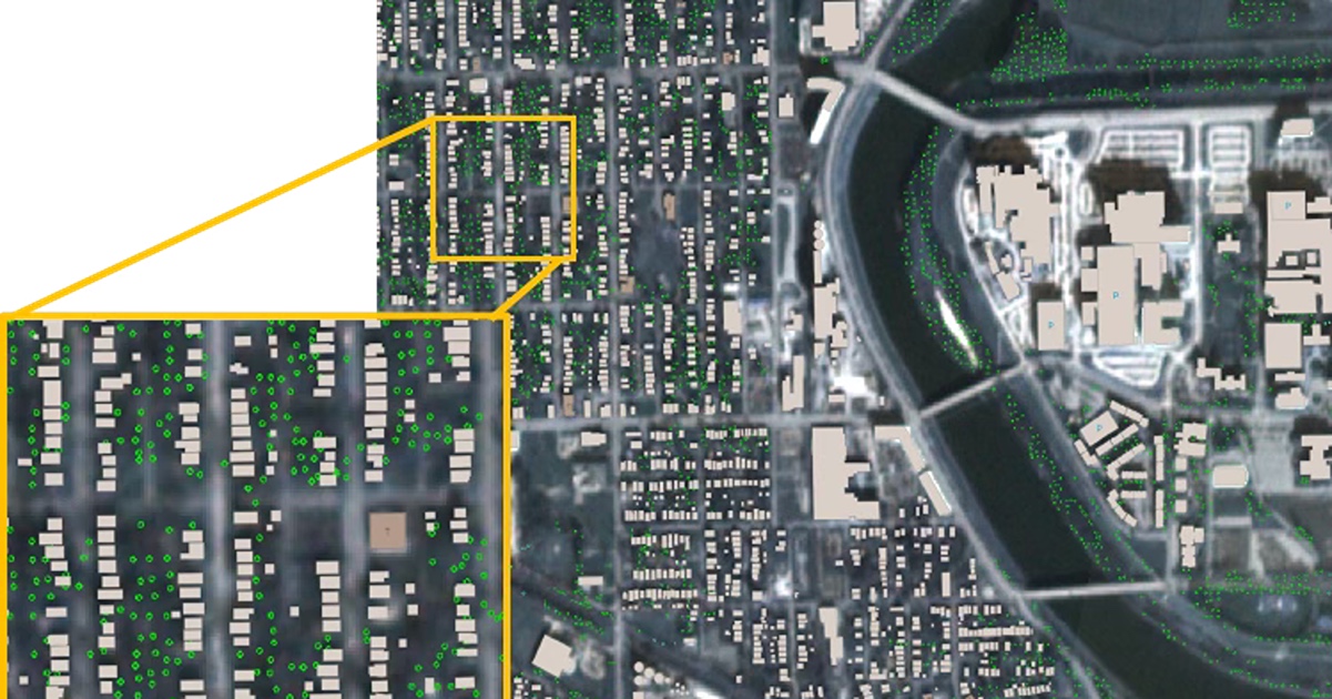
Using satellite data, Aliaga and his associates recently completed a digital inventory of trees and buildings in 330 cities with populations greater than 100,000 in all 50 states. Aliaga’s expertise includes developing solutions for urban issues such as growth, traffic, atmospheric conditions, extreme weather — especially heat — and flooding.
“What are the urban codes, the urban policies we should change or implement to reduce likelihood of fire starting and fire transmission?” Aliaga asked.
To complement passive methods, some more fire-prone areas may call for active precautions. Urban fire studies could help answer some seemingly simple questions such as where to put fire stations and fire hydrants.
Aliaga’s team has conducted a study stemming from the 2018 Camp Fire in California. The researchers found that by using archived satellite data, they can inventory every tree before and after a fire.
 Bera specializes in artificial intelligence, computer graphics and robotics. He aspires to use drones or other robotics technologies to help track urban fire behavior.
Urban fires are less studied than wildfires, Bera noted. “This is a genuine problem, maybe more so now than it was before,” he said. “It is studied, but not to the degree of how plumes or gases or the fire itself spreads.” His interest includes studying how fires can create choke points where people are unable to breathe.
“Fire is a kind of fluid. How do these fires spread? And how do the gases spread? Can we build better predictive models in urban situations?” asked Bera.
Fei explains why Purdue is an ideal place to be conducting this critical research. “At Purdue, we call what we have ‘excellence at scale,’ which means I can literally walk across the street and have access to incredible faculty in world-ranked colleges and departments. Together we see and pursue the possibilities of what digital forestry can achieve,” said Fei.
The Institute for Digital Forestry’s ultimate goal is to measure every tree on the planet — the crown, stem and height — with high accuracy.
“We use the ‘measuring every tree on the planet’ slogan to inspire us, to be our moon-shot goal,” Fei said. He compares the global forestry inventory to sound budgeting practices.
If you know the quality and quantity of your resources, you can be a better manager.
- Songlin Fei, professor and Dean’s Chair for Remote Sensing in the Department of Forestry & Natural Resources
Featured Stories
Jackie Getson, project manager for Purdue’s Institute for Digital Forestry, has built a...

Brady Hardiman, associate professor of forestry and natural resources and sustainability...

Many of the 60,000 wildfires occurring annually across the U.S. flare up in the intersection...

Digital tools are transforming how forests and natural resources are managed. A new fellowship...
A Purdue University digital forestry team has created a computational tool to obtain and analyze...
Purdue University has grown a thriving forest of more than 2,000 geographic information systems...
This research is a part of Purdue’s presidential One Health initiative, which involves research at the intersection of human, animal and plant health and well-being.