

Forestry & Natural Resources
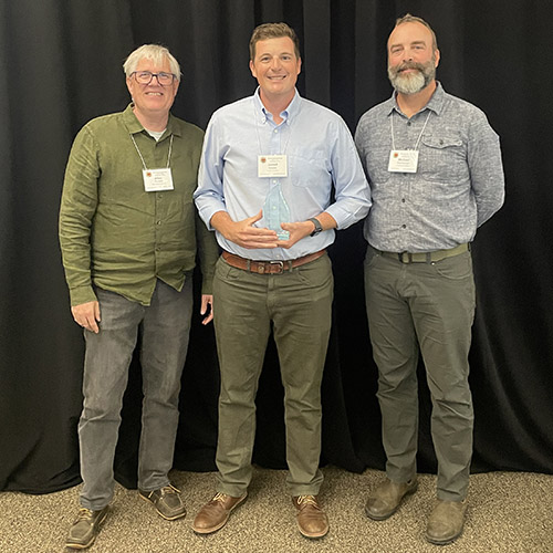
Jessica Elliott - Esri Student of the Year
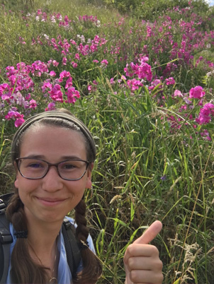
Jessie Elliott, a master’s degree student under Drs. Songlin Fei and Liz Flaherty in the Purdue Department of Forestry and Natural Resources, was among 22 students selected as 2020 Esri Development Center Students of the Year.
“Jessie is working on cutting-edge, interdisciplinary research in digital forestry that can greatly benefit the management and conservation of forests in Indiana and beyond,” Dr. Fei said. “I am really proud that Jessie’s work was recognized by Esri, the global leading company in GIS.”
According to its website, Esri is the global market leader in GIS (geographic information system). The Esri Development Center Program for Higher Education confers special status and benefits upon a select few leading university departments that challenge their students to develop innovative applications based upon the ArcGIS platform, the world’s most powerful mapping and spatial analytics software.”
Award recipients receive a $500 cash prize, a plaque and an Esri Developer Summit registration.
“I'm incredibly fortunate to have two amazing advisors, Songlin Fei and Elizabeth Flaherty,” Elliott said. “Songlin saw the description for the award and recommended that I apply because of my work, which uses R in tandem with ArcGIS to process LiDAR data. I didn't expect to get the award after I looked up the past recipients and saw how impressive their work was, but I'm very lucky that they chose me. I think it's largely a result of being in such a supportive lab environment.
“I started working in the Fei lab as an undergraduate as part of the NSF REU project and was introduced to LiDAR. Dr. Liz LaRue mentored me and taught me everything I know about LiDAR. She's an incredible teacher/friend, the coauthor on this project, and is one of the main reasons I continued on to graduate school. It means a lot that I'm able to validate the time and effort that my advisors and coworkers have spent helping me by receiving this award. I've found research to be very humbling. There's so much that I don't know and have had to learn, so to be recognized for that is very encouraging.”
Elliott is studying the impact of emerald ash borers and canopy structure on understory invasion.
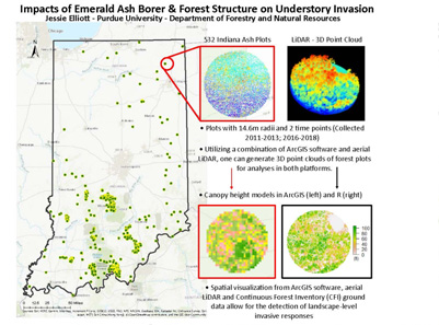
“Through my research, I hope to understand the relationship between forest canopy structural diversity and invasion,” Elliott explains. “The idea being that when an invasive insect pest like Emerald Ash Borer begins killing trees in a forest, this opens up light gaps in the canopy. I believe that this could facilitate the spread of invasive understory plants into the landscape if they are able to capitalize on the new pockets of light reaching the forest floor faster than native plants. Often invasives are fast-growing, and they seed earlier and more prolifically than native shrubs. This means that a disturbance to the upper canopy might have secondary effects on the forest understory. Preliminary results have found that taller and more heterogeneous canopies are related to lower invasive species richness. This could potentially indicate some degree of biotic resistance.”
In its summary of Elliott’s research, Esri said this about the project:
Elliott’s research takes advantage of GIS, remote sensing, and Big Data to address a critical environmental issue. More specifically, she utilized a combination of ArcGIS mapping software, aerial light detection and ranging (LiDAR) and Continuous Forest Inventory (CFI) ground data to assess the potential impacts of Emerald Ash Borer (Agrilus planipennis) and forest structure on understory plant invasion. ArcGIS allowed for the selection and visualization of forest ash (Fraxinus spp.) plots across Indiana, and along with statewide continuous LiDAR and plot level CFI data, she created a comprehensive image of the forested landscape. Future research will focus on using the spatial capabilities offered by ArcGIS in tandem with the quantitative analyses that can be performed with LiDAR and CFI metrics to detect landscape-level invasive response.
Elliott finished her bachelor’s degree in wildlife with minors in forestry and anthropology. She is working on her master’s degree in wildlife and forestry.
Purdue was designated as an Esri Development Center school in 2017. The EDC Student of the Year award is open to all Purdue students and sponsored by the Purdue Libraries Learning Council. The winner is chosen based on outstanding achievements in development of innovative tools, applications or techniques using ArcGIS.
In 2018 and 2019, civil engineering PhD students Nikhil Sangwen and Sayan Dey were recognized by the Purdue EDC as Students of the Year.
Featured Stories

Of mice, birds and men: Purdue researcher builds a simulation of how wild birds and rodents affect the spread of avian flu on farms
Trask is writing a new narrative about rats, birds and people as he pursues his doctorate in...
FNR Celebrates Awards, Honors from Spring, Summer 2026
Several Forestry and Natural Resources students, staff and recent alumni have been recognized for...
Purdue Researchers Use 3D Printing to Make Open-Source Alternative to Costly Groundwater Sensors
A plume of contamination spreads underground. A building's foundation weakens. A wetland...
Jarred Brooke Receives Early Career Award for Prescribed Fire Work
Jarred Brooke, Extension wildlife specialist, was honored with a Career Achievement Award at the...
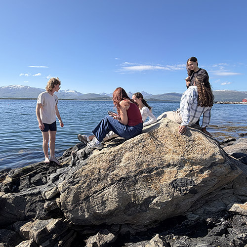
FNR Field Report: Brett Cox Recaps Week 2 of Sweden Study Abroad Trip
Sophomore forestry major Brett Cox recaps week 2 of the Sustainable Natural Resources study...

From Sweden to Norway to Turks and Caicos
Morgan Hamilton, a rising senior majoring in aquatic sciences, has had an...