

Forestry & Natural Resources
Agricultural Research and Graduate Education
Forestry & Natural Resources
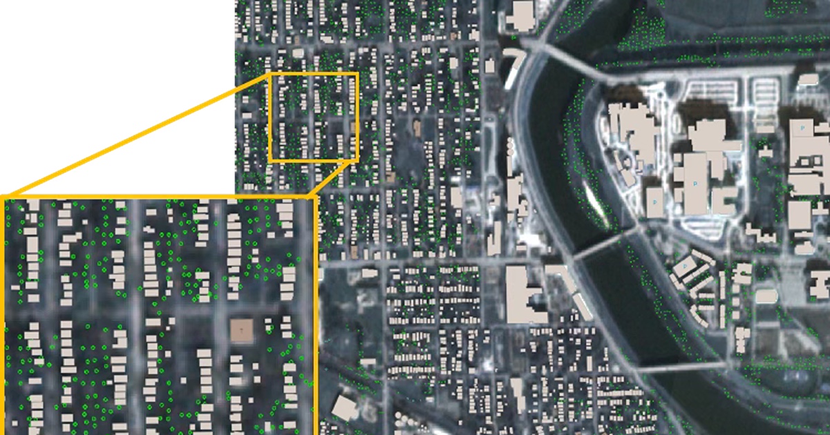
Meeting the wildfire threat with digital models of the real world
Many of the 60,000 wildfires occurring annually across the U.S. flare up in the intersection between wildland and urban areas. The National Science Foundation has awarded a grant of nearly $2.5 million to help first responders, planners, and policymakers address this threat strategically.
The project team, led by Purdue University, will generate digital twins, model how fire spreads, and conduct resilience studies based on the catastrophic wildfires that affected Los Angeles in 2025 and Gatlinburg, Tenn., in 2016. The collaboration includes researchers from the University at Buffalo and University of California, Los Angeles.
Together they seek to innovate the application of geospatial (location-specific) data that have become increasingly available at multiple resolutions, formats and time scales. Doing so will involve overcoming multiple technical gaps that have hindered the creation of digital twins for urban and wildland environments.
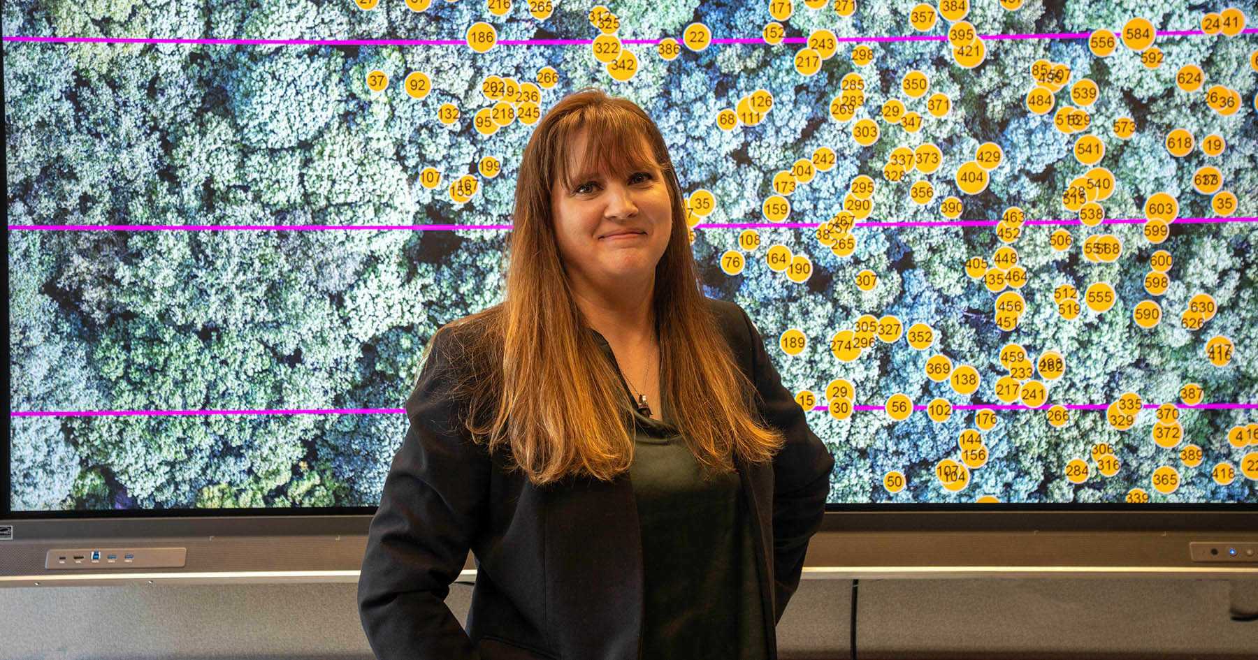
“In this project, we will demonstrate novel tools for the proactive and effective prevention and mitigation of wildfires at the wildland-urban interface,” said Purdue’s Ayman Habib, the Thomas A. Page Professor of Civil Engineering, who leads the effort.
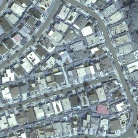 Aerial photograph of a Los Angeles County neighborhood before the 2025 Palisades Fire. (Credit: Imagery © 2024-2025 Maxar)
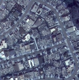 Photo of the same neighborhood after the Palisades Fire. (Credit: Imagery © 2024-2025 Maxar)
Project co-leaders are Purdue’s Daniel Aliaga, associate professor of computer science; and Ertugrul Taciroglu, professor of civil and environmental engineering, UCLA; Negar Elhami-Khorasani, associate professor of civil, structural and environmental engineering, University at Buffalo; and Maria Frediani, project scientist at the National Center for Atmospheric Research.
The team also includes Purdue’s Songlin Fei, director of the Institute for Digital Forestry, and institute members Tonglin Zhang, associate professor of statistics; and Michael Jenkins, professor of forestry and natural resources. Both are members of the Institute for Digital Forestry.
Habib and Fei bring significant experience in using geospatial data for forest inventory fuel characterization and wildfire risk assessment. Taciroglu, Aliaga and Habib focus on 3D modeling of urban environments, and processing geospatial data acquired from spaceborne, airborne and terrestrial platforms.
University at Buffalo’s Elhami-Khoresani and NCAR’s Frediani develop and apply fire spread models for both urban and wildland settings, integrating geospatial and contextual data from multiple sources. Purdue’s Zhang and Jenkins use geospatial data for forest inventory, fuel characterization, and wildfire risk assessment.
“As virtual representations of physical objects or systems, digital twins can be continuously updated using geospatial and contextual data from various sensors and other sources,” said Purdue’s Songlin Fei. “We plan to devise a framework for generating digital twins that process the various types of available geospatial data needed for wildfire studies.
The digital twins resulting from this project will replicate the physical, environmental and human dynamics related to gray and green infrastructure, which will enable improved planning, sustainability and resilience through effective modeling of how fires spread.
This will enable improved planning, sustainability, and resilience through effective fire spread modeling. Gray infrastructure details include building location, footprint outline, roof type, exterior siding, eaves and fences. Green infrastructure information includes terrain, canopy height, tree density and species, snags, fallen woody debris and understory.
The new project will integrate two complementary fire spread models that simulate wildfire behavior in both wildland and built environments, as well as their interface at different scales that require varying levels of input detail. The first model, a weather research and forecasting fire system, numerically simulates the dynamic interactions between fires and the atmosphere at scales ranging from an inch or two up to hundreds of miles.
The other model, developed by University at Buffalo’s Elhami-Khoresani, simulates fire spread in the wildland-urban interface and built environments that incorporate vegetation, structure, and non-combustible surfaces as fuel categories. In collaboration with the Insurance Institute for Business and Home Safety, Elhami-Khoresani has applied the model to fire-spread simulations to generate guidelines for community wildfire resilience.
Several cities have built 3D models to represent buildings, roads and other infrastructure that visualize dynamic city systems. However, they remain geographically disconnected, focus on either urban or wildland environments, but not the interfacing regions. They also lack standard formats and cannot be scaled up for wildfire risk assessment and mitigation efforts.
For model development, validation, and improvement, the researchers will draw upon detailed pre- and post-fire data on an unprecedented urban scale. The ULCA team has focused much of its work on the 2025 Los Angeles fire. The Purdue team has done likewise for the 2016 Gatlinburg fire in Tennessee. The researchers will use these two case-study regions of vastly different geographies, climates, ignition risks and demographics, to devise broadly applicable methods for wildfire management.
While the wildfire risk in wildland-urban interface regions has largely plagued the West, the Gatlinburg Fire in Tennessee highlighted the danger in the East. The speed and severity of the latter fire were unprecedented. The Gatlinburg Fire was more catastrophic than any fire of the last century in the eastern U.S. Continued increases in drought severity and other extreme weather events across the region raise the likelihood of such recurring extreme fire events.
 Airborne LiDAR forest profile data collected before the 2016 Gatlinburg Chimney Top 2 Fire in Tennessee. (Credit: Purdue Digital Photogrammetry Research Group)
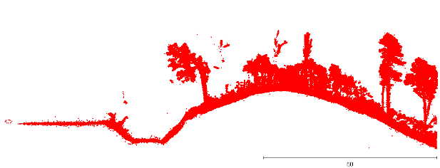 Forest profile data of the same area in 2025 collected by Purdue’s drone system. (Credit: Purdue Digital Photogrammetry Research Group)
 Advancing fire resilience against such catastrophes requires an approach that involves stakeholder engagement along with the project’s other components. The researchers will incorporate community input in evaluating local fire resilience capacity, offering real-world validation of model assumptions during the digital twin and fire-spread modeling.
The team brings ongoing collaborations with the City of Los Angeles and fire ecologists at the Great Smoky Mountains National Park in Tennessee to the project. The researchers will meet regularly with the stakeholders from Los Angeles and Gatlinburg to present interim findings, solicit input on data needs and model outputs, and adjust research directions as needed.
In the educational arena, the team will offer a menu of wildfire-related curricula and online modules for existing university and professional development courses.
Computer science and AI are cornerstones of Purdue Computes — a comprehensive initiative that spans computing departments, physical AI, quantum science and semiconductor innovation.
Related Posts


Forestry & Natural Resources
Fellowship helps natural resources professionals build digital skills — 22 April 2026
Forestry & Natural Resources
Digital forestry team combines AI with satellite data to monitor urban trees — 17 February 2026
Featured Stories
From playing on the pitch to perfecting it for World Cup athletes
It’s a field she knows well, a field she has run up and down countless times. Now she is...
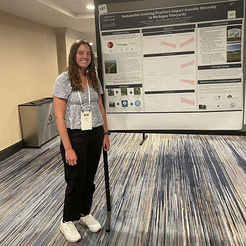
PhD Student Sarah Grimes Researches Sustainability, Biodiversity of Michigan Vineyards
Sarah Grimes’ work in the Pijanowski lab focuses on how sustainable management practices at...
Plants employ rare method to produce valuable chemical compound
Land plants have spent nearly half a billion years honing a vast array of metabolic skills that...
FNR Field Report: Sam Lillie Provides Sweden-Norway Study Abroad Week 3 Recap
Senior Sam Lillie provides a recap of the Week 3 action during the Sustainable Natural Resources...
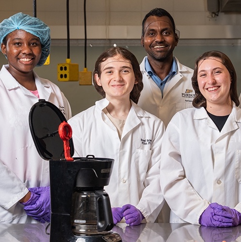
Brewing up safety: Purdue Food Science and the Heartland Food Products Group team up to revolutionize coffee cleanliness
Coffee makers are everywhere — from kitchens to office break rooms — brewing up...
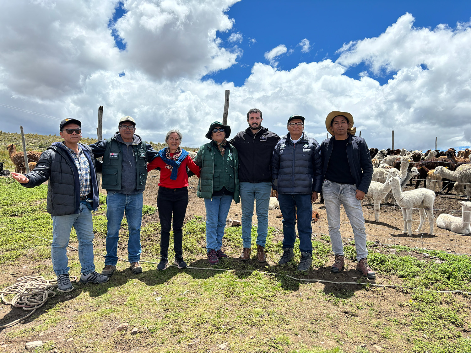
Advancing animal genetics through global collaboration
Global partnerships strengthen Purdue animal genetics research.