

Advanced Ecological Sensing & Analytics
Signature Themes
The Department of Forestry and Natural Resources is characterized by broad scholarly activities across diverse disciplines and mission areas. To highlight the department's impactful programming, we have organized our integrative activities across three cross-cutting themes: Conservation Science, Advanced Ecological Sensing and Analytics, and Environmental One Health.
The Advanced Ecological Sensing and Analytics Theme integrates digital methods with ecological and natural resource science. Digital technologies continue to change how humans interact with the planet. The fields of forestry, aquatic sciences, and wildlife ecology are no exception. Faculty, staff and students in the Purdue Department of Forestry & Natural Resources are leading the way, adopting new sensing technology and analyzing data with state-of-the-art computing and analytical tools, including AI. Advanced ecological sensors and analytics are used locally to provide knowledge regarding local ecosystems with unprecedented detail that can then be applied to answer questions at a global scale.
At the local level, faculty, staff and students use advanced technologies to measure the health and number of wildlife species, assess habitat quality and provide actionable insights for managers. This work includes estimating deer populations with a new level of accuracy. The department is building drones and backpack scanners that can assess the health and size of every tree in a forest automatically. We are also applying water quality sensors to measure how management activities alter habitat for fish and other aquatic species. Forestry & Natural Resources researchers are using advanced analytics to provide insights across continents and the planet. This includes efforts to count every tree, tools that track migrating birds, and models that predict water quality at a global scale.

Meeting the Wildfire Threat with Digital Models of the Real World

Brady Hardiman, associate professor of forestry and natural resources and sustainability...
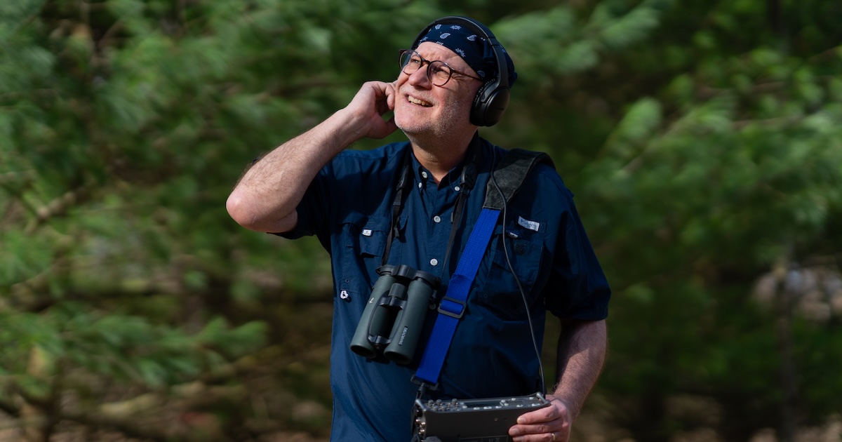
Bryan Pijanowski, professor in Purdue University’s Department of Forestry and Natural...

Digital tools are transforming how forests and natural resources are managed. A new fellowship...
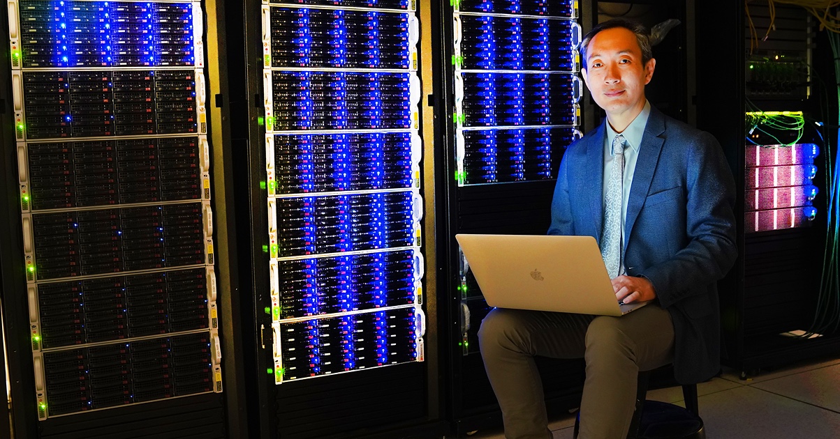
Jingjing Liang, a University Faculty Scholar and associate professor of forestry and natural...
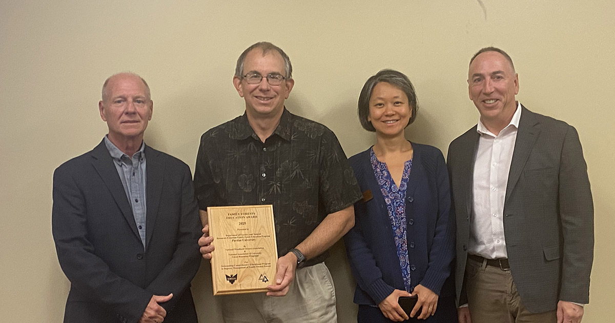
The Purdue FNR extension team was named as a recipient of the Family Forests Comprehensive...
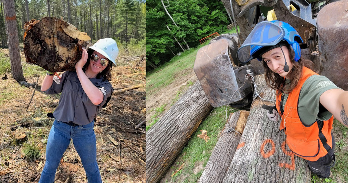
Sophia DeMoss, a senior forestry major with a concentration in forest management, got hands-on...

Reimagining Forest Management with AI
PERSEUS (Promoting Economic Resilience and Sustainability of the Eastern U.S. Forests) is a USDA-funded initiative led by the Institute for Digital Forestry that is reshaping how forests are measured, modeled and managed. The project brings together faculty, students and partners from across the country to combine advanced remote sensing, artificial intelligence and geospatial technologies to better understand forest conditions and predict future ecosystem trends. By producing more accurate, timely and spatially detailed forest information, PERSEUS supports landowners, managers and policymakers in making informed, data-driven decisions that balance economic viability with long-term sustainability. A key focus of the project is education and workforce development, providing hands-on training and digital forestry experiences for students and professionals. Through research, collaboration and education, PERSEUS is helping ensure healthier, more resilient forests while preparing the next generation of leaders in natural resource science.
Helping Birds Navigate Human Skies
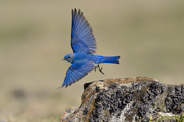
Bird migration is an awe-inspiring spectacle of mass animal movement, involving billions of individuals undertaking journeys that span hemispheres. However, human development has drastically altered the landscape through which birds migrate, exposing birds to many threats and stressors along their routes, and contributing to precipitous population declines. Nocturnal migrants, representing 80% of migratory species in North America, are vulnerable to light pollution, as it can alter important aspects of their navigation and lead to fatal collisions with anthropogenic structures. In its work, the Aeroecology Lab, led by Kyle Horton, uses many approaches, including weather radar and nocturnal flight call monitoring, to examine how migrants interact with light and buildings at local and continental scales. Their work is guided by the goal of advancing the understanding of these interactions so that strategies that mitigate the effects of light pollution and better protect migratory species can be developed. Purdue AeroEco Lab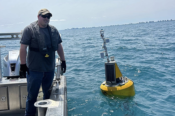
Smart Buoys Deliver Real-Time Data
Illinois-Indiana Sea Grant (IISG) has three buoys deployed in Lake Michigan near Michigan City, Indiana, and Chicago and Wilmette, Illinois. These buoys are not just to inform scientists and weather forecasters but also are highly utilized by anglers, boaters, paddlers, surfers, swimmers and educational programs about current lake conditions. These buoys collect real-time data on wind speed, wave height and water temperatures to provide valuable insights for scientists and the public. The buoys are part of IISG’s commitment to expanding sensing capabilities in southern Lake Michigan and educating the public on the Great Lakes. Over the past 13 years, the program has gradually grown with the addition of the Chicago buoy in 2021 and continuous upgrades to the existing buoys. Keeping the buoys afloat takes a wide range of partnerships that include the Purdue Department of Civil Engineering, the Great Lakes Observing System and Freeboard Technology. IISG Buoys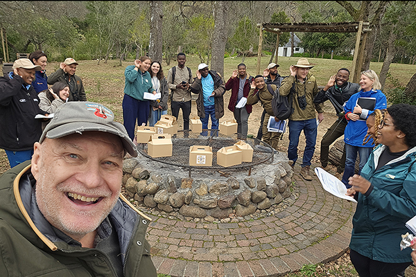
Decoding Nature Through Sound Data
The Center for Global Soundscapes, directed by Bryan Pijanowski, led workshops in South Africa and Peru over the past year, providing hands-on experience to students and researchers interested in analyzing passive acoustic remote sensing data for use in biodiversity assessments. Participants from seven African countries gathered in Stellenbosch, South Africa, for training in August 2025. The Amazonian Rainforest biodiversity workshop at the University of Technology and Engineering (UTEC) in Lima, Peru, in February 2026 reached students and faculty from several Peruvian universities along with natural resources managers from not-for-profit organizations and staff from Peru’s National Forestry and Wildlife Service.
These workshops focused on training in soundscape analytics, a workflow-based approach for discovering ecological patterns and meaning in large soundscape datasets. Participants were educated about combining acoustic signal processing, acoustic indices, machine learning, visual analytics, data integration and ecological interpretation. The workshops involved computer-based instruction, field deployment and sensor network designs as well as individual- and group-based listening exercise techniques conducted in the field.
Reimagining Forest Management with AI
PERSEUS (Promoting Economic Resilience and Sustainability of the Eastern U.S. Forests) is a USDA-funded initiative led by the Institute for Digital Forestry that is reshaping how forests are measured, modeled and managed. The project brings together faculty, students and partners from across the country to combine advanced remote sensing, artificial intelligence and geospatial technologies to better understand forest conditions and predict future ecosystem trends. By producing more accurate, timely and spatially detailed forest information, PERSEUS supports landowners, managers and policymakers in making informed, data-driven decisions that balance economic viability with long-term sustainability. A key focus of the project is education and workforce development, providing hands-on training and digital forestry experiences for students and professionals. Through research, collaboration and education, PERSEUS is helping ensure healthier, more resilient forests while preparing the next generation of leaders in natural resource science.
Helping Birds Navigate Human Skies
Bird migration is an awe-inspiring spectacle of mass animal movement, involving billions of individuals undertaking journeys that span hemispheres. However, human development has drastically altered the landscape through which birds migrate, exposing birds to many threats and stressors along their routes, and contributing to precipitous population declines. Nocturnal migrants, representing 80% of migratory species in North America, are vulnerable to light pollution, as it can alter important aspects of their navigation and lead to fatal collisions with anthropogenic structures. In its work, the Aeroecology Lab, led by Kyle Horton, uses many approaches, including weather radar and nocturnal flight call monitoring, to examine how migrants interact with light and buildings at local and continental scales. Their work is guided by the goal of advancing the understanding of these interactions so that strategies that mitigate the effects of light pollution and better protect migratory species can be developed. Purdue AeroEco Lab
Smart Buoys Deliver Real-Time Data
Illinois-Indiana Sea Grant (IISG) has three buoys deployed in Lake Michigan near Michigan City, Indiana, and Chicago and Wilmette, Illinois. These buoys are not just to inform scientists and weather forecasters but also are highly utilized by anglers, boaters, paddlers, surfers, swimmers and educational programs about current lake conditions. These buoys collect real-time data on wind speed, wave height and water temperatures to provide valuable insights for scientists and the public. The buoys are part of IISG’s commitment to expanding sensing capabilities in southern Lake Michigan and educating the public on the Great Lakes. Over the past 13 years, the program has gradually grown with the addition of the Chicago buoy in 2021 and continuous upgrades to the existing buoys. Keeping the buoys afloat takes a wide range of partnerships that include the Purdue Department of Civil Engineering, the Great Lakes Observing System and Freeboard Technology. IISG Buoys
Decoding Nature Through Sound Data
The Center for Global Soundscapes, directed by Bryan Pijanowski, led workshops in South Africa and Peru over the past year, providing hands-on experience to students and researchers interested in analyzing passive acoustic remote sensing data for use in biodiversity assessments. Participants from seven African countries gathered in Stellenbosch, South Africa, for training in August 2025. The Amazonian Rainforest biodiversity workshop at the University of Technology and Engineering (UTEC) in Lima, Peru, in February 2026 reached students and faculty from several Peruvian universities along with natural resources managers from not-for-profit organizations and staff from Peru’s National Forestry and Wildlife Service.
These workshops focused on training in soundscape analytics, a workflow-based approach for discovering ecological patterns and meaning in large soundscape datasets. Participants were educated about combining acoustic signal processing, acoustic indices, machine learning, visual analytics, data integration and ecological interpretation. The workshops involved computer-based instruction, field deployment and sensor network designs as well as individual- and group-based listening exercise techniques conducted in the field.